
Free Coordinates calculator support Old Egyptian Datum by TATUKGIS
Download a Coordinate calculator for free
You need to sign Up to get a Free Link
Sunday, April 20, 2008
Free Coordinate Calculator
Friday, April 18, 2008
Old Egyptian 1907 Datum

Old Egyptian Datum Transformation Parameters
| Belt Parameters | Purple Belt | Extended Purple Belt | Red Belt | Blue Belt |
| Covering Area | West of 29 deg E; North of 28 deg 11 min N Bounds: 24.71 28.18 29.0 33.58 | West of 29 deg E; South of 28 deg 11 min N Bounds: 25.0,21.99 29.0,28.18 | East of 29 deg E Bounds: 29.0,21.99 36.9,33.75 | Bounds: 32.5,27.7 36.9,31.31 |
| | 27 | 27 | 31 | 35 |
| Central Parallel (DEG) N | 30 | 30 | 30 | 30 |
| False Easting (m) | 700000 | 700000 | 615000 | 300000 |
| False Northing (m) | 200000 | 1200000 | 810000 | 1100000 |
| Scale factor | 1 | 1 | 1 | 1 |
Datum Old Egyptian 1907
Ellipsoid Helmert 1906
Projection Transverse Mercator
Tuesday, April 15, 2008
SUEZ CANAL

The Suez Canal is a large man-made canal in Egypt, west of the Sinai Peninsula. It is 163 km (101 miles) long and 300 m (984 ft) wide at its narrowest point, and runs between Port Said on the Mediterranean Sea, and Suez on the Red Sea.
Read More
Suez Canal: Wikipedia
Suez Canal: MSN Encarta
Download Spatial Files
DXF Format
KMZ Google Earth Format
Projection of the files:
Projection: Lat/Long
Ellipsoid: WGS84
Datum: WGS84
Monday, April 14, 2008
Egypt SRTM 90m Digital Elevation Data

====================================================================
Data File Name : srtm_42_08.zip
Latitude min: 20 N max: 25 N
Longitude min: 25 E max: 30 E
Center point : Latitude 22.50 N Longitude 27.50 E
http://droppr.org/srtm/v4.1/6_5x5_TIFs/srtm_42_08.zip
=====================================================
Data File Name : srtm_43_08.zip
Latitude min: 20 N max: 25 N
Longitude min: 30 E max: 35 E
Center point : Latitude 22.50 N Longitude 32.50 E
http://droppr.org/srtm/v4.1/6_5x5_TIFs/srtm_43_08.zip
=======================================================
Data File Name : srtm_44_08.zip
Mask File Name: srtm_mk_44_08.zip
Latitude min: 20 N max: 25 N
Longitude min: 35 E max: 40 E
Center point : Latitude 22.50 N Longitude 37.50 E
http://droppr.org/srtm/v4.1/6_5x5_TIFs/srtm_44_08.zip
===============================================================
Data File Name : srtm_42_07.zip
Latitude min: 25 N max: 30 N
Longitude min: 25 E max: 30 E
Center point : Latitude 27.50 N Longitude 27.50 E
http://droppr.org/srtm/v4.1/6_5x5_TIFs/srtm_42_07.zip
============================================================
Data File Name : srtm_43_07.zip
Latitude min: 25 N max: 30 N
Longitude min: 30 E max: 35 E
Center point : Latitude 27.50 N Longitude 32.50 E
http://droppr.org/srtm/v4.1/6_5x5_TIFs/srtm_43_07.zip
===============================================================
Data File Name : srtm_43_06.zip
Latitude min: 30 N max: 35 N
Longitude min: 30 E max: 35 E
Center point : Latitude 32.50 N Longitude 32.50 E
Saturday, April 12, 2008
Qattara Depression, Fill Volume and area

The attached report explain how to use digital Elevation model (DEM) to estimate the required volume of water to fill the Qattara Depression (Western Desert, Egypt)
http://ragabr.googlepages.com/Qattara_Deression_Report.pdf
Friday, April 11, 2008
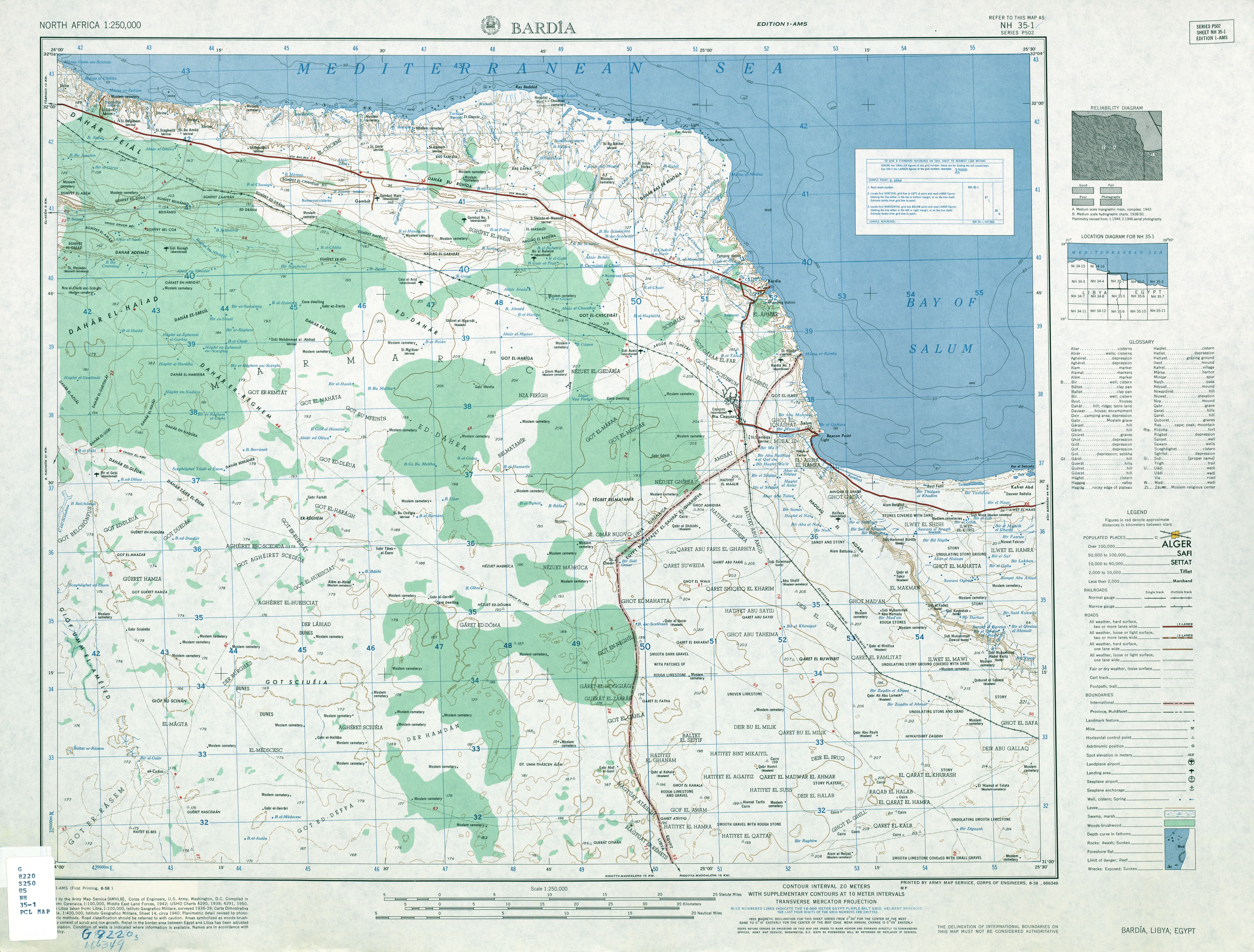
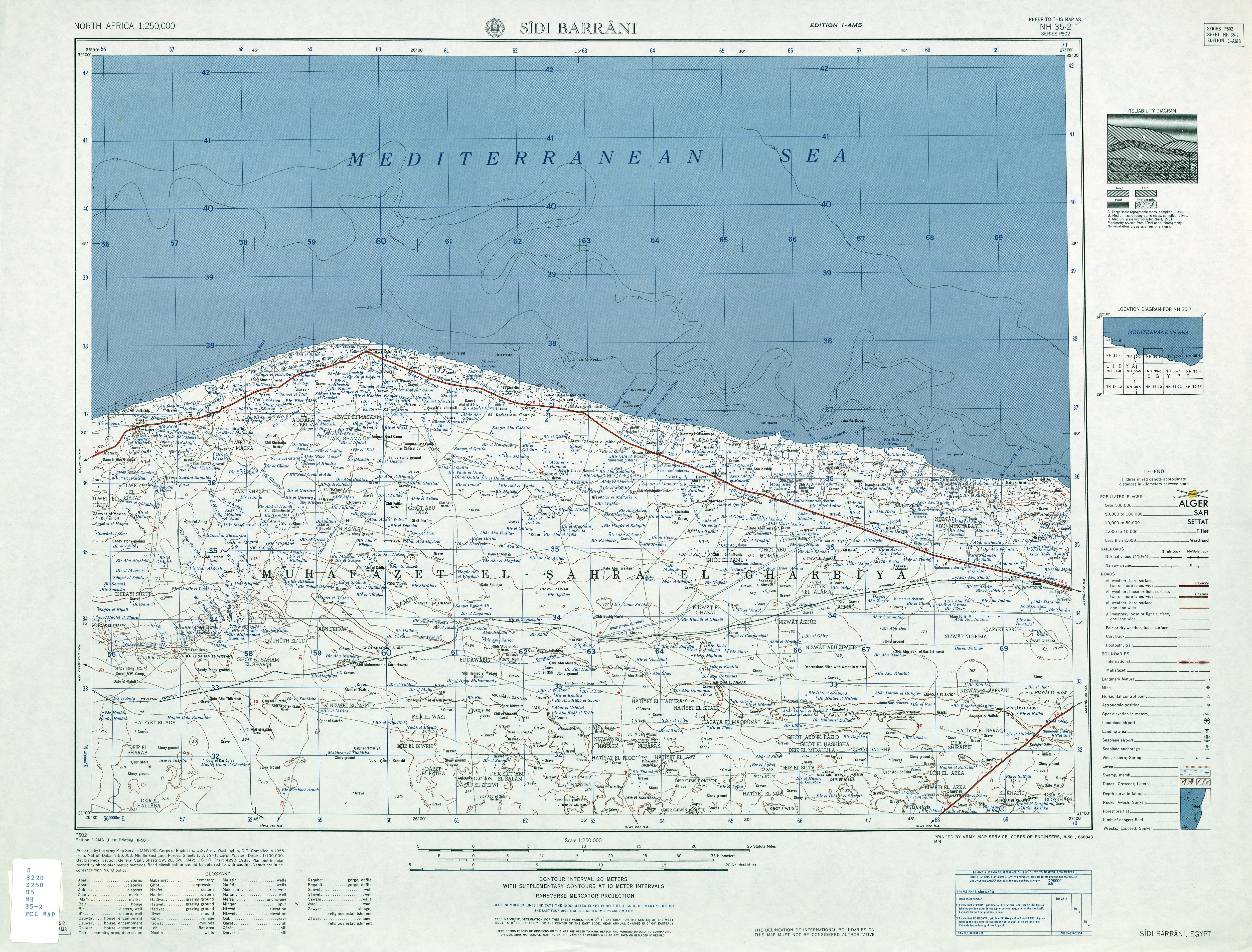
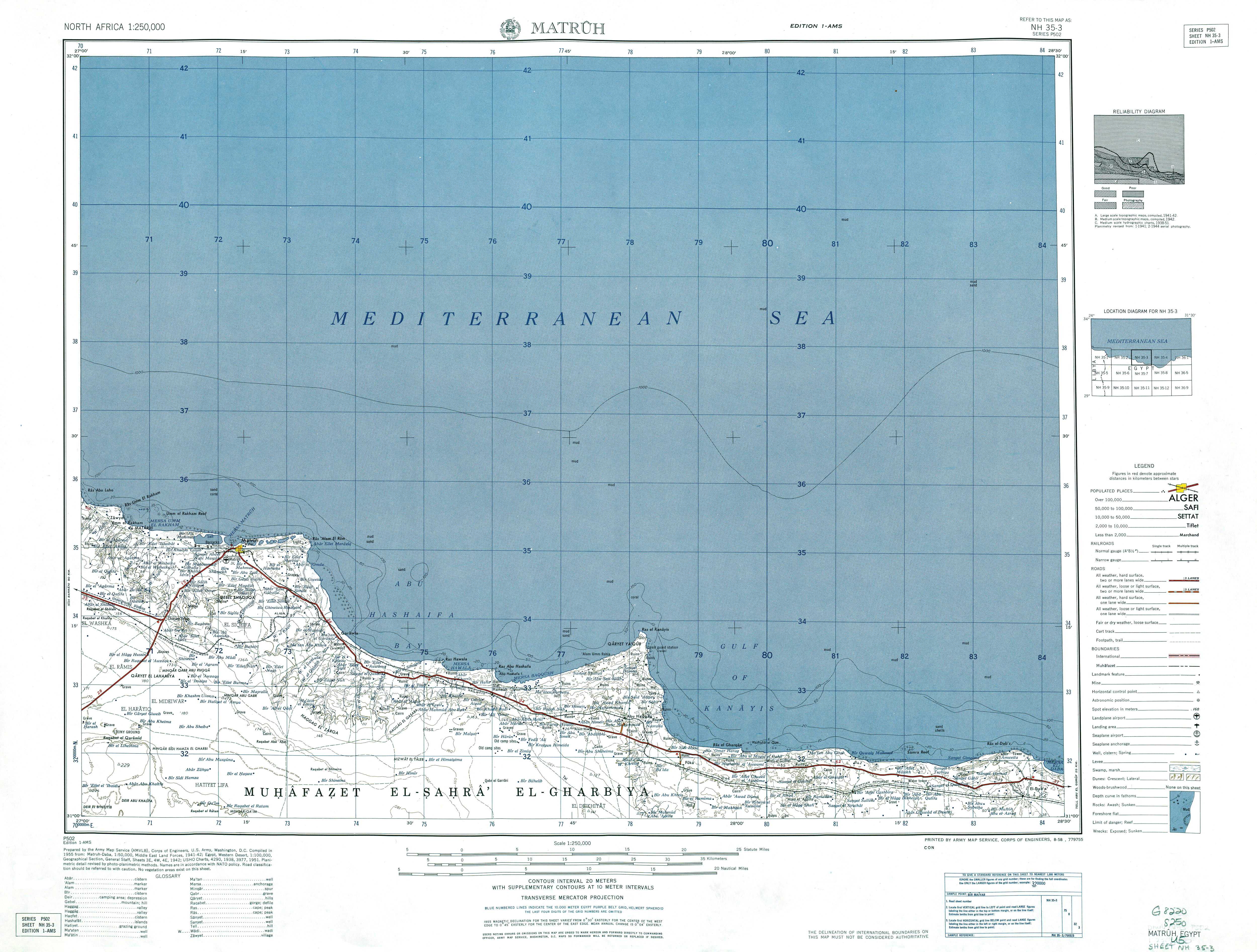
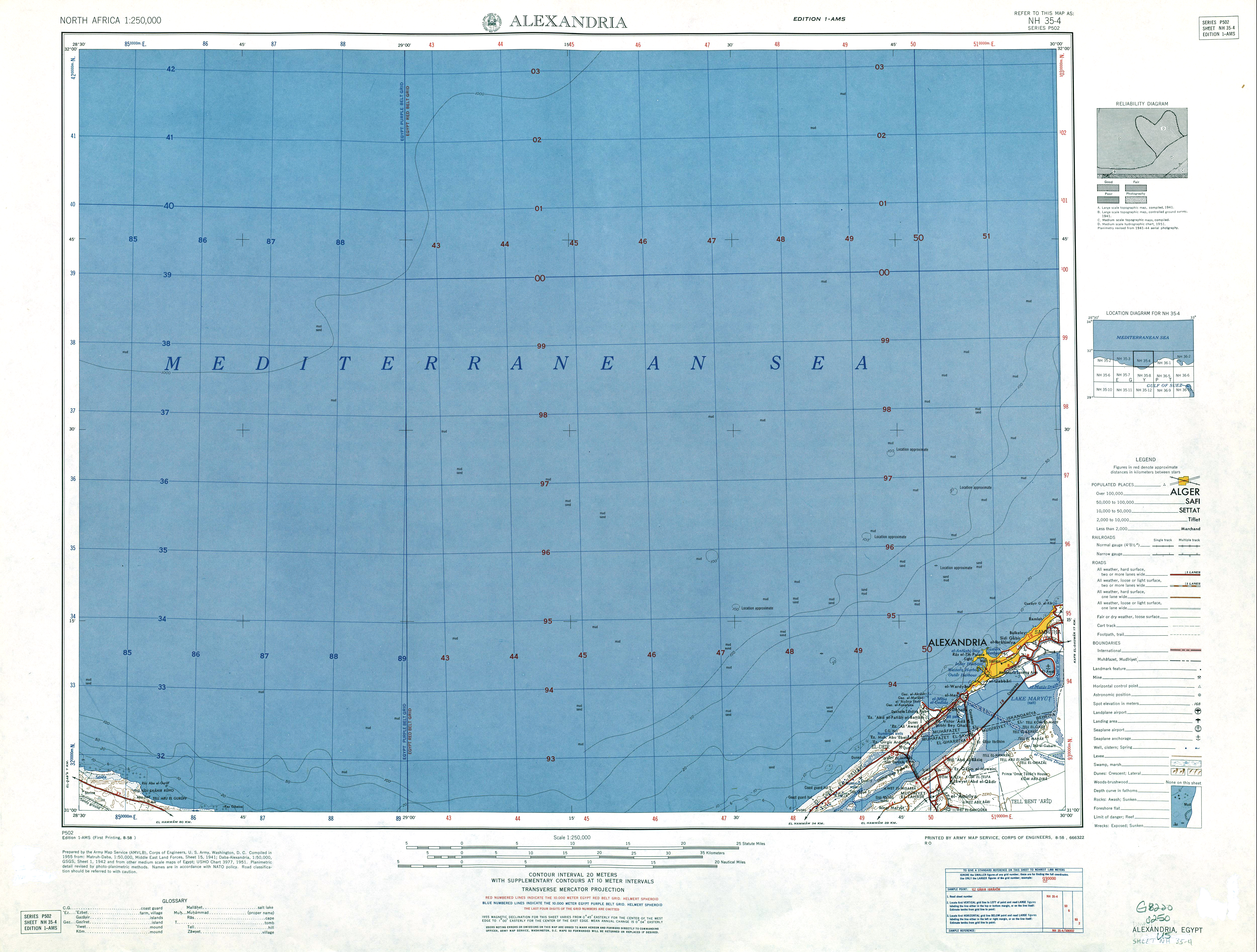
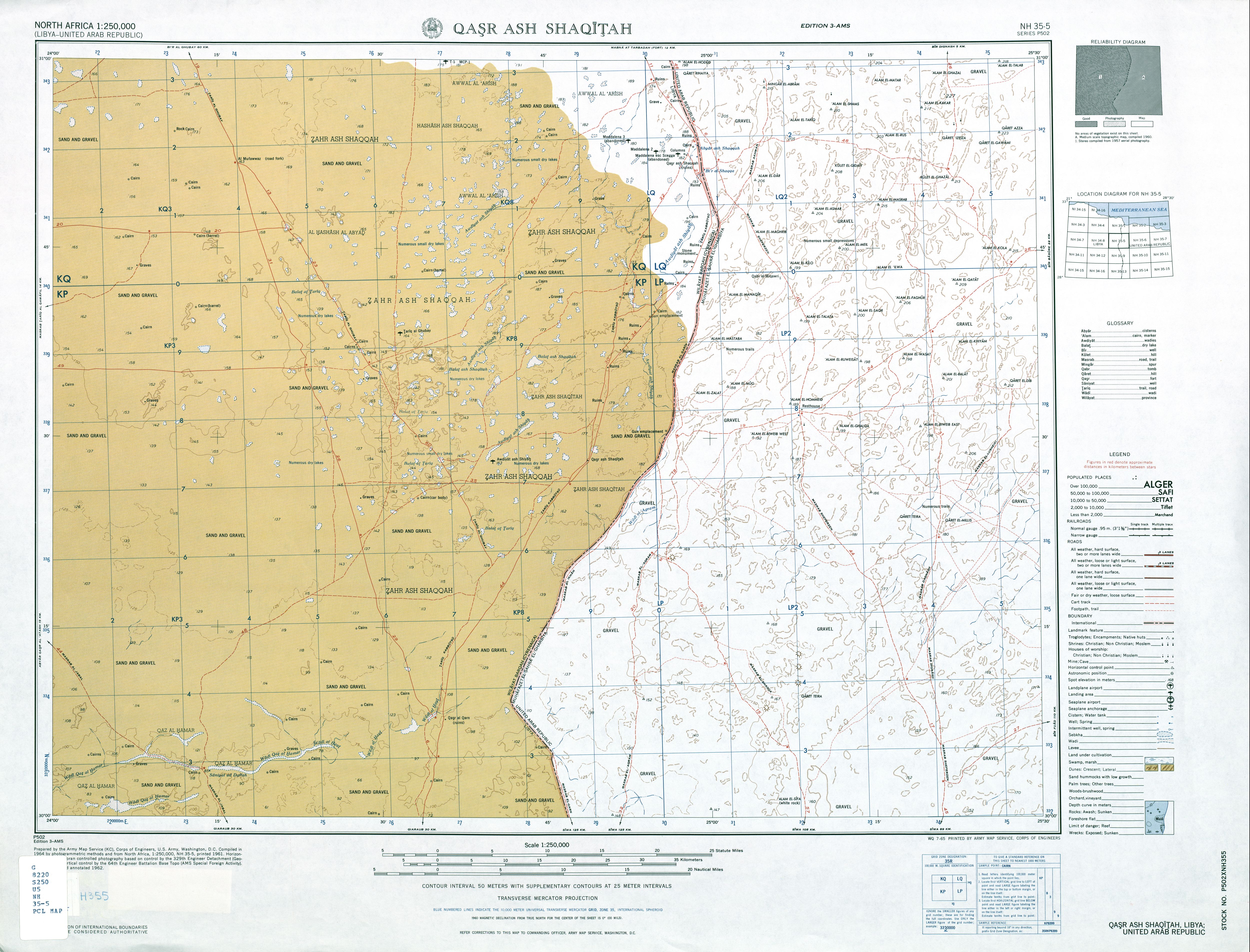
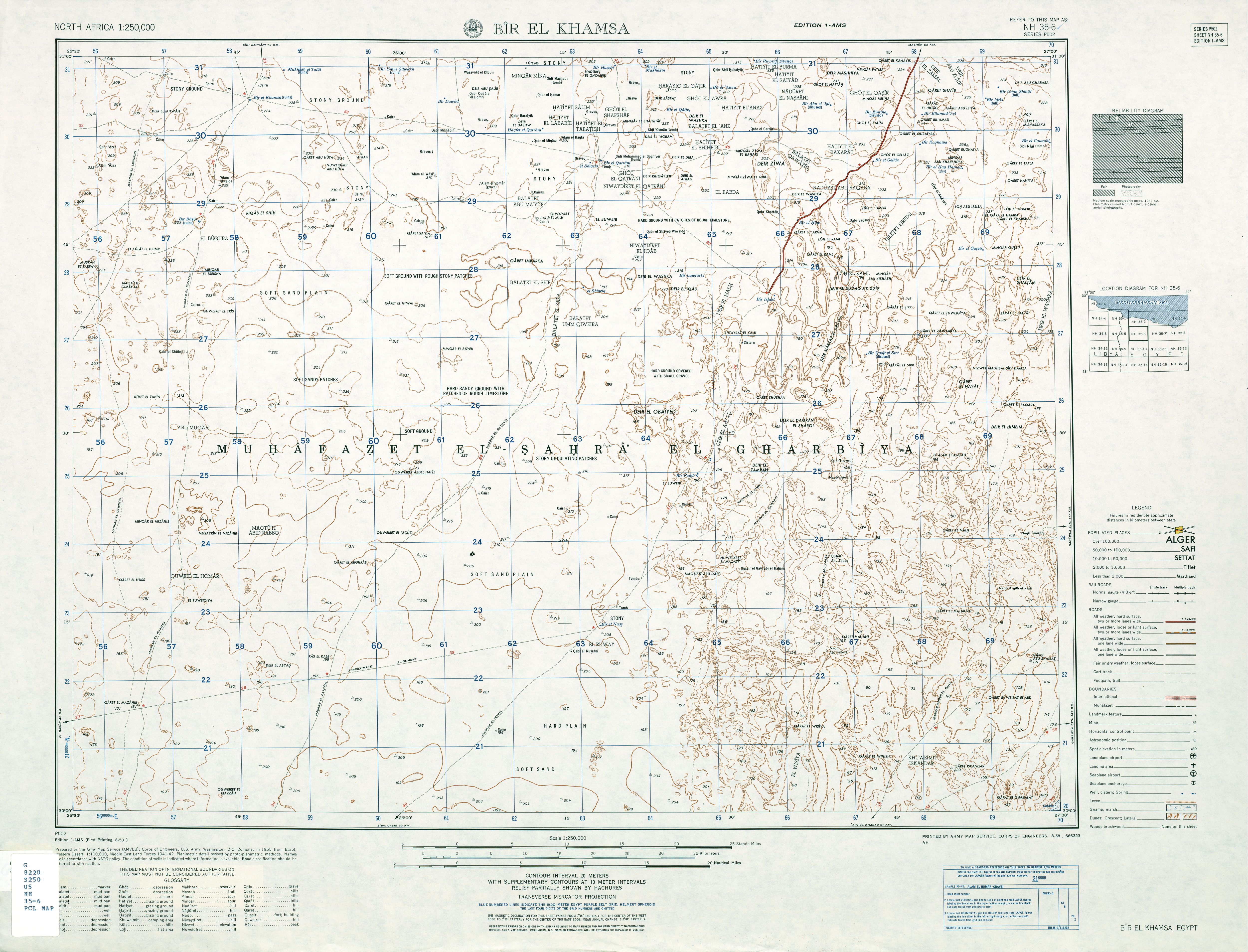
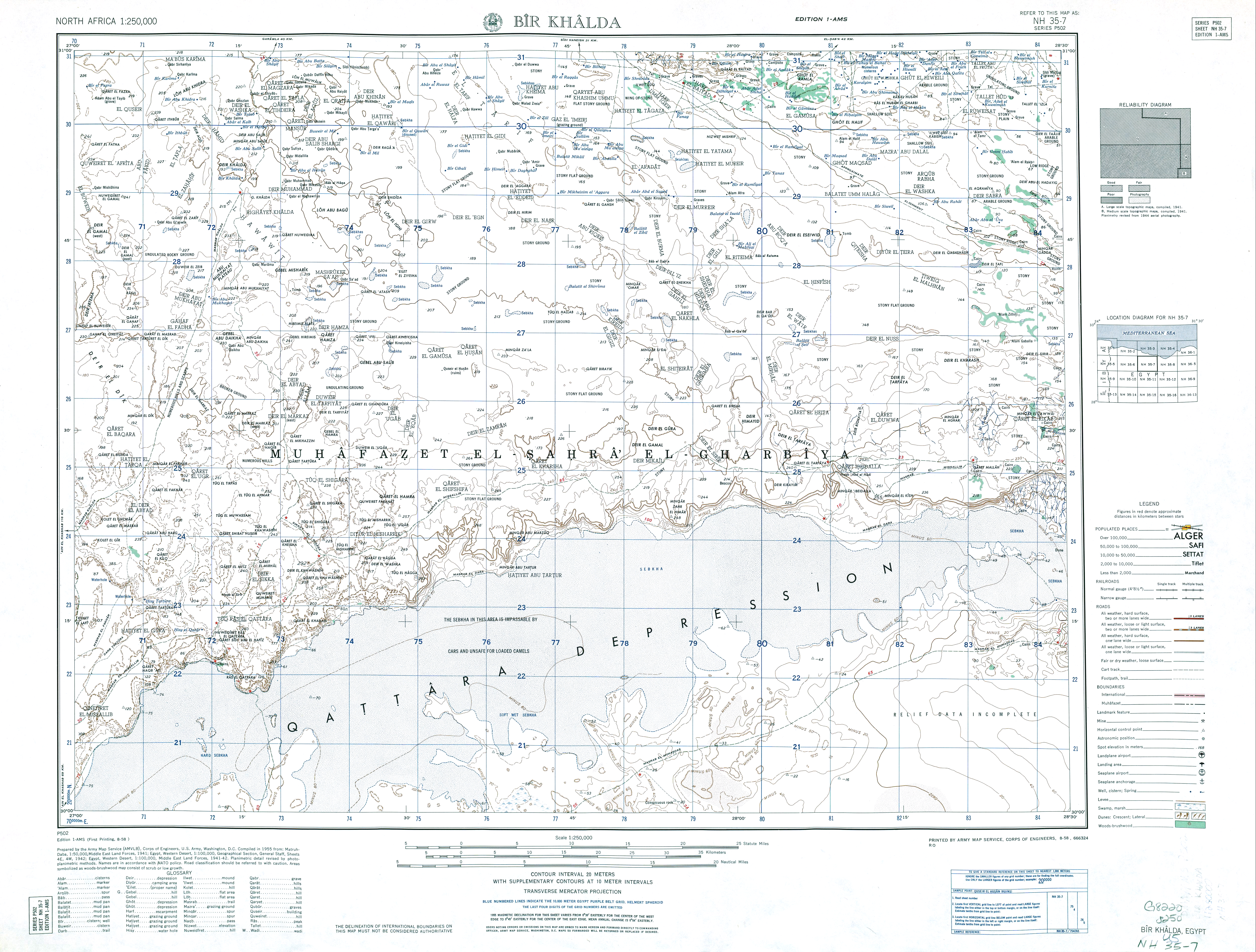
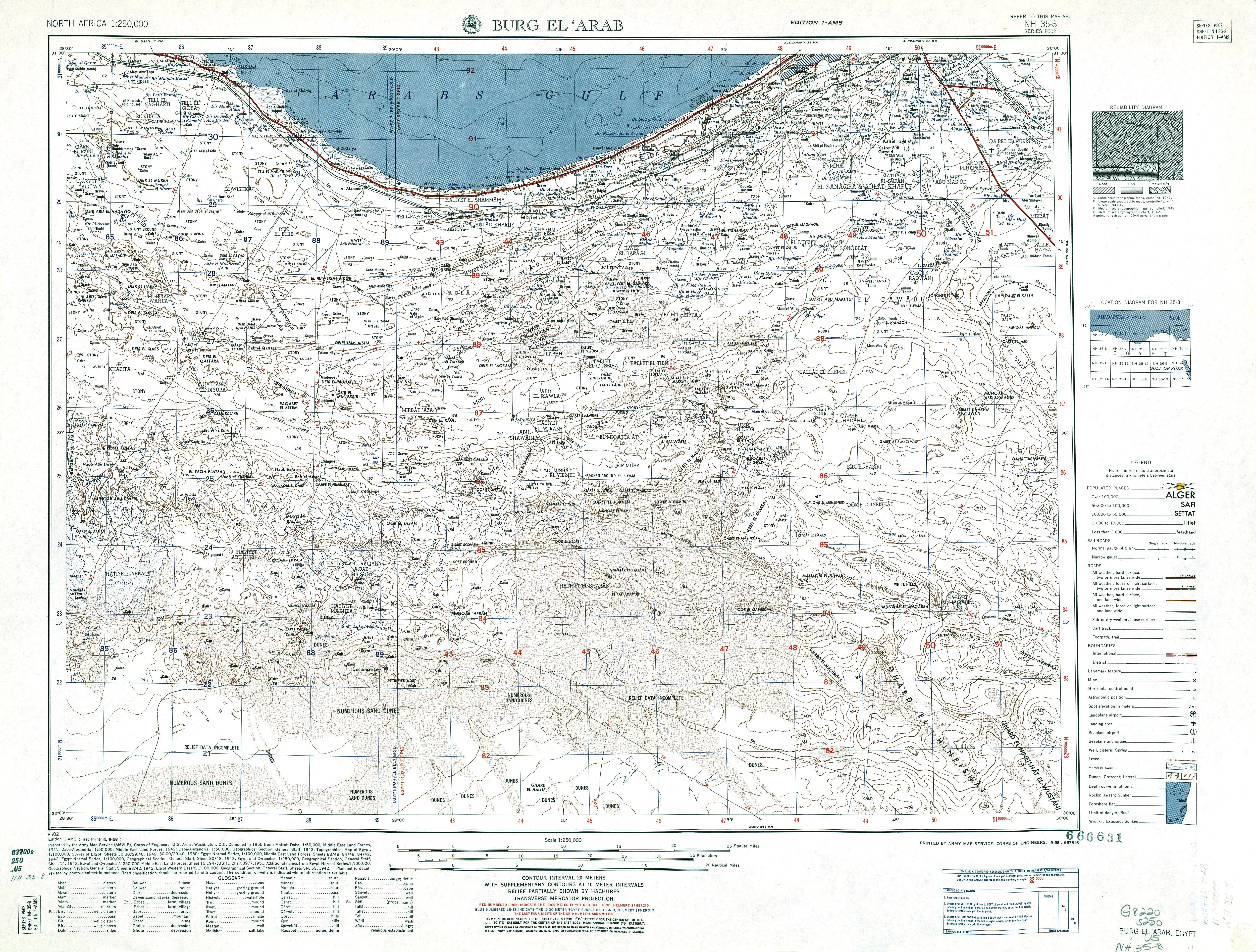
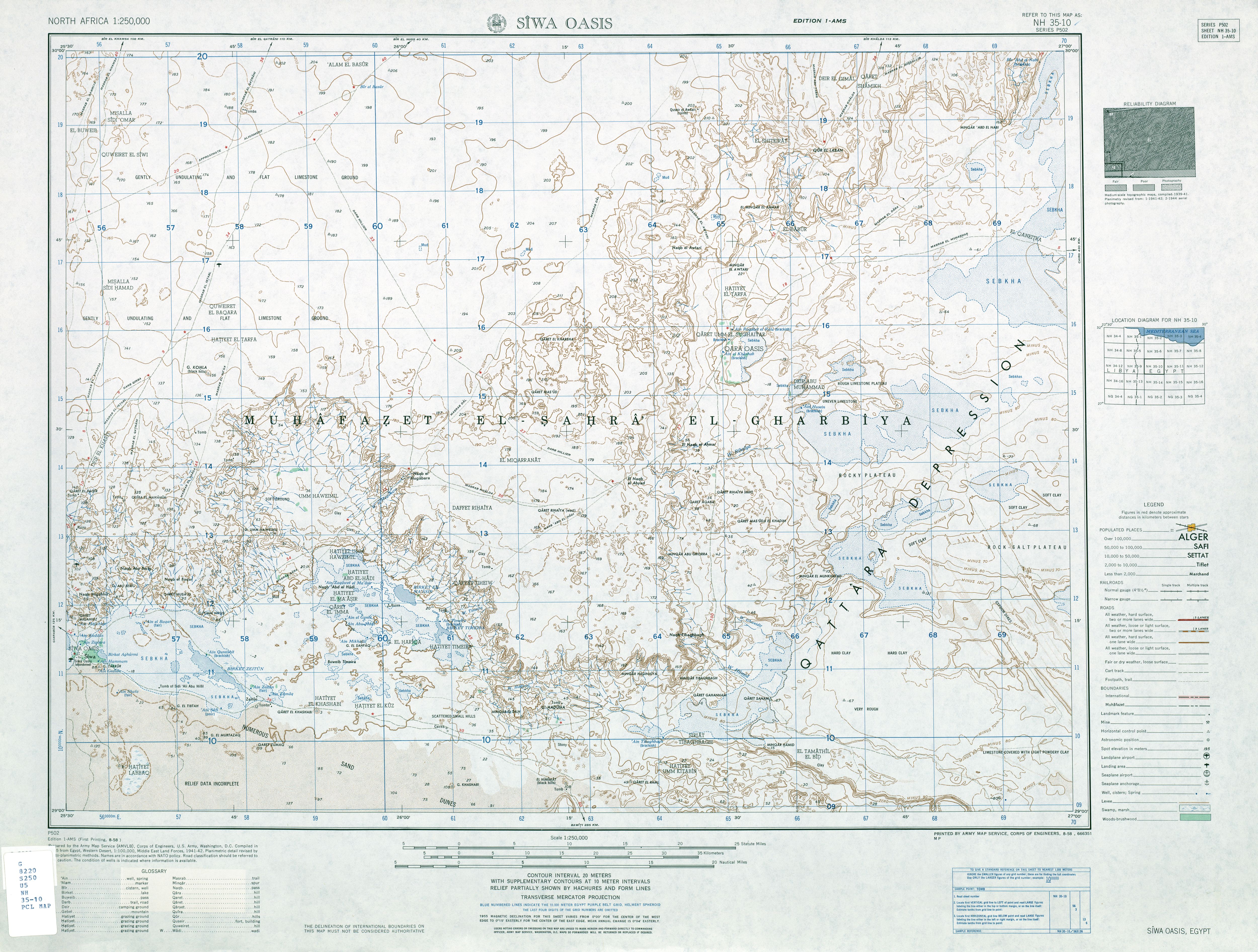
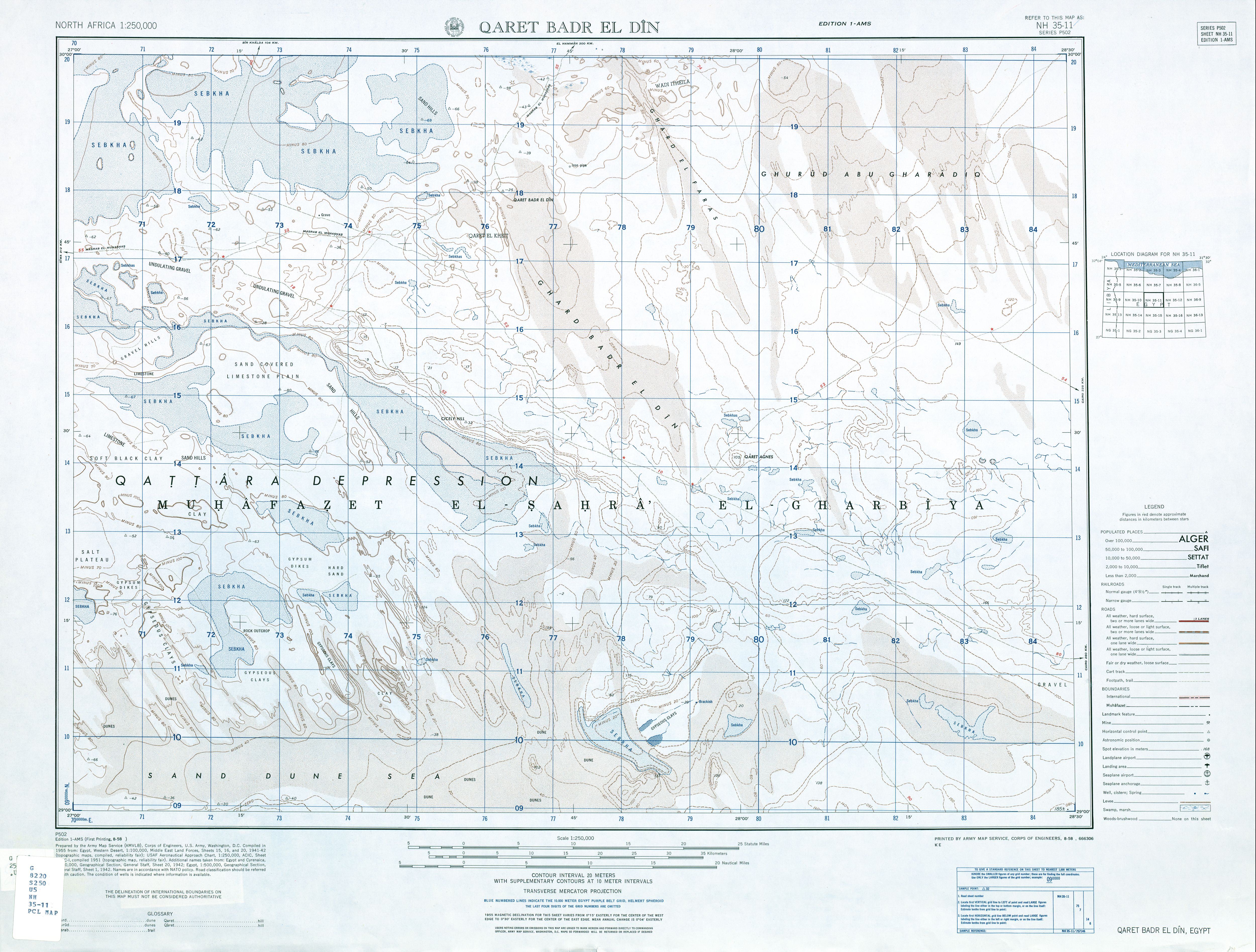
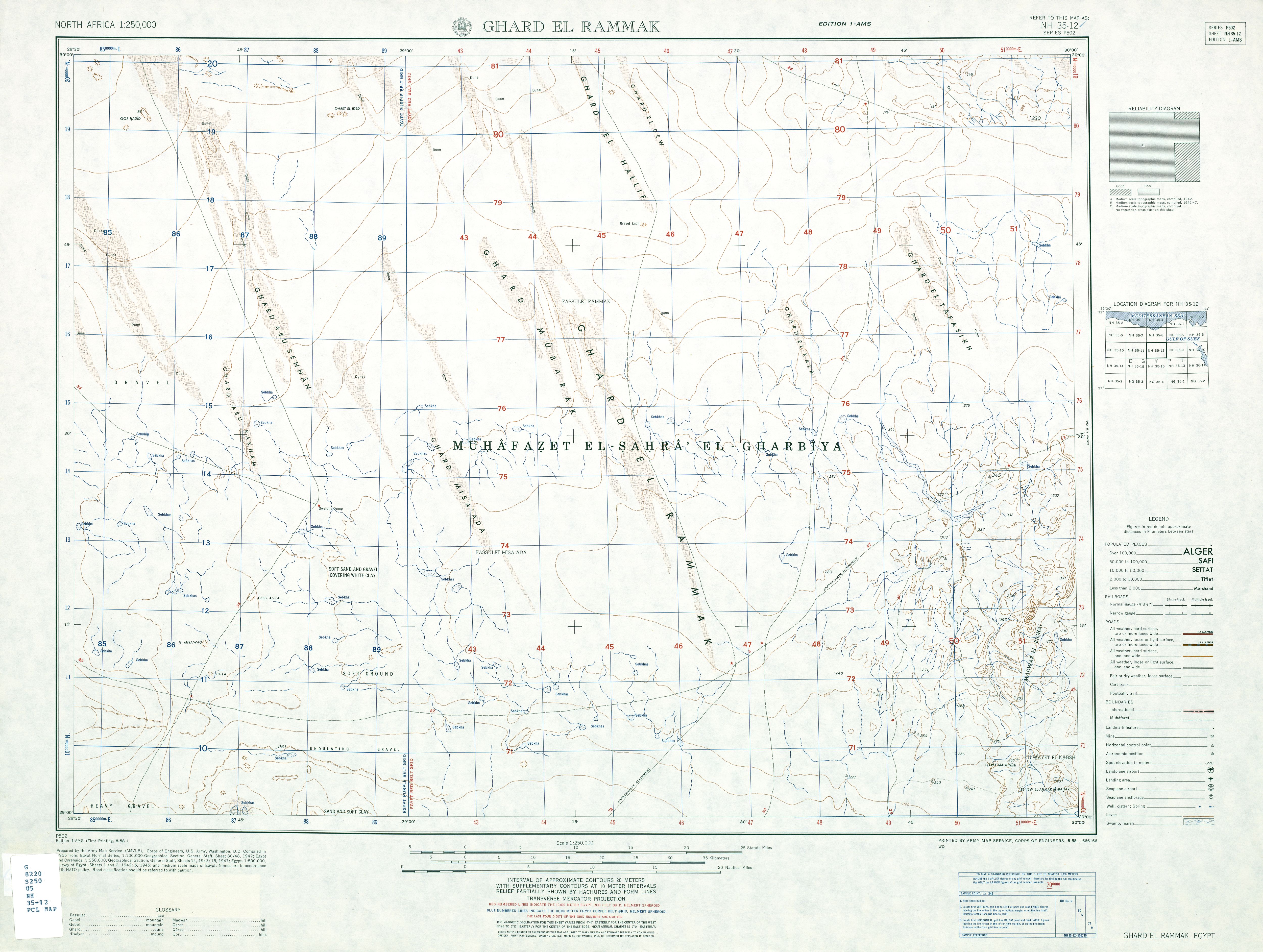
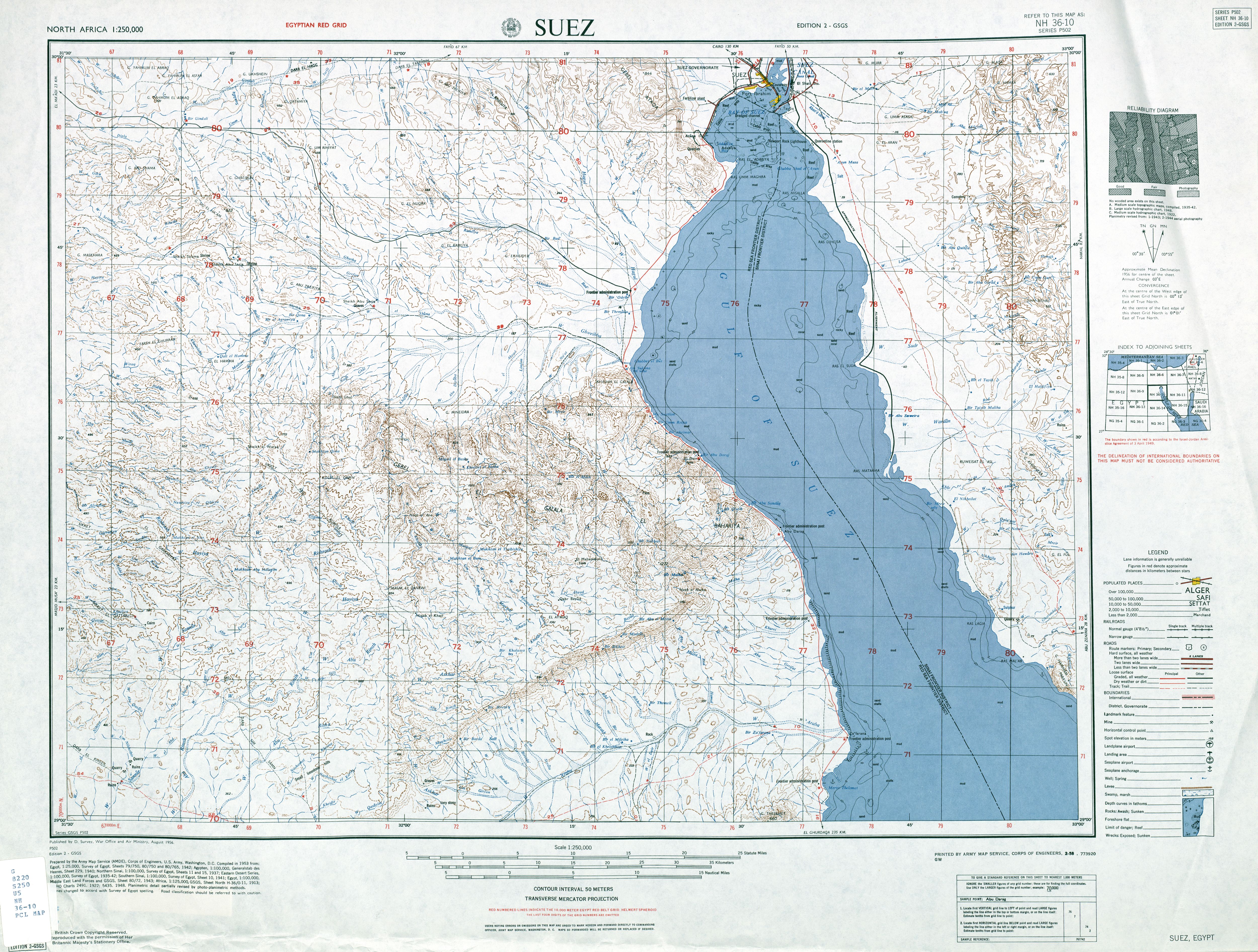
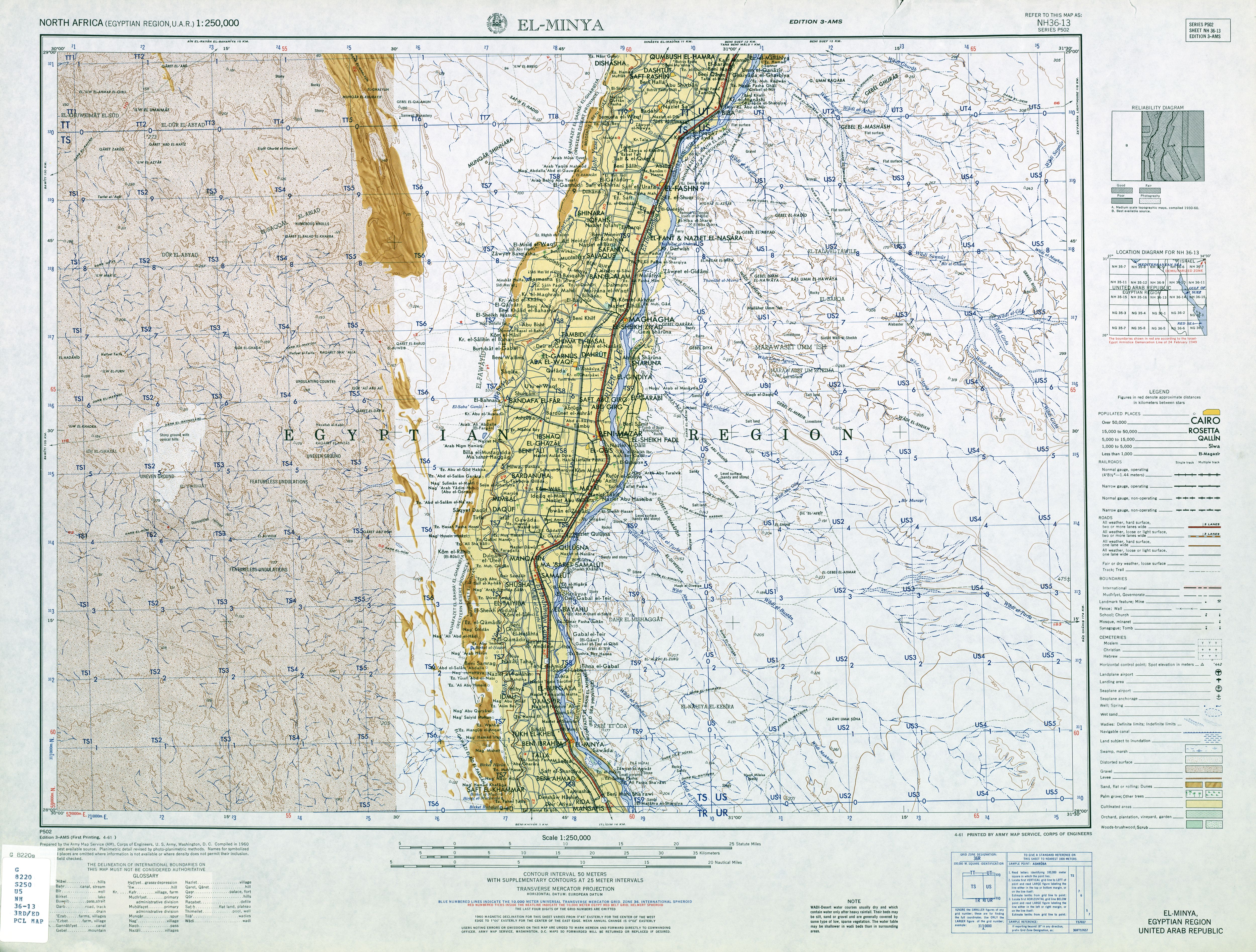
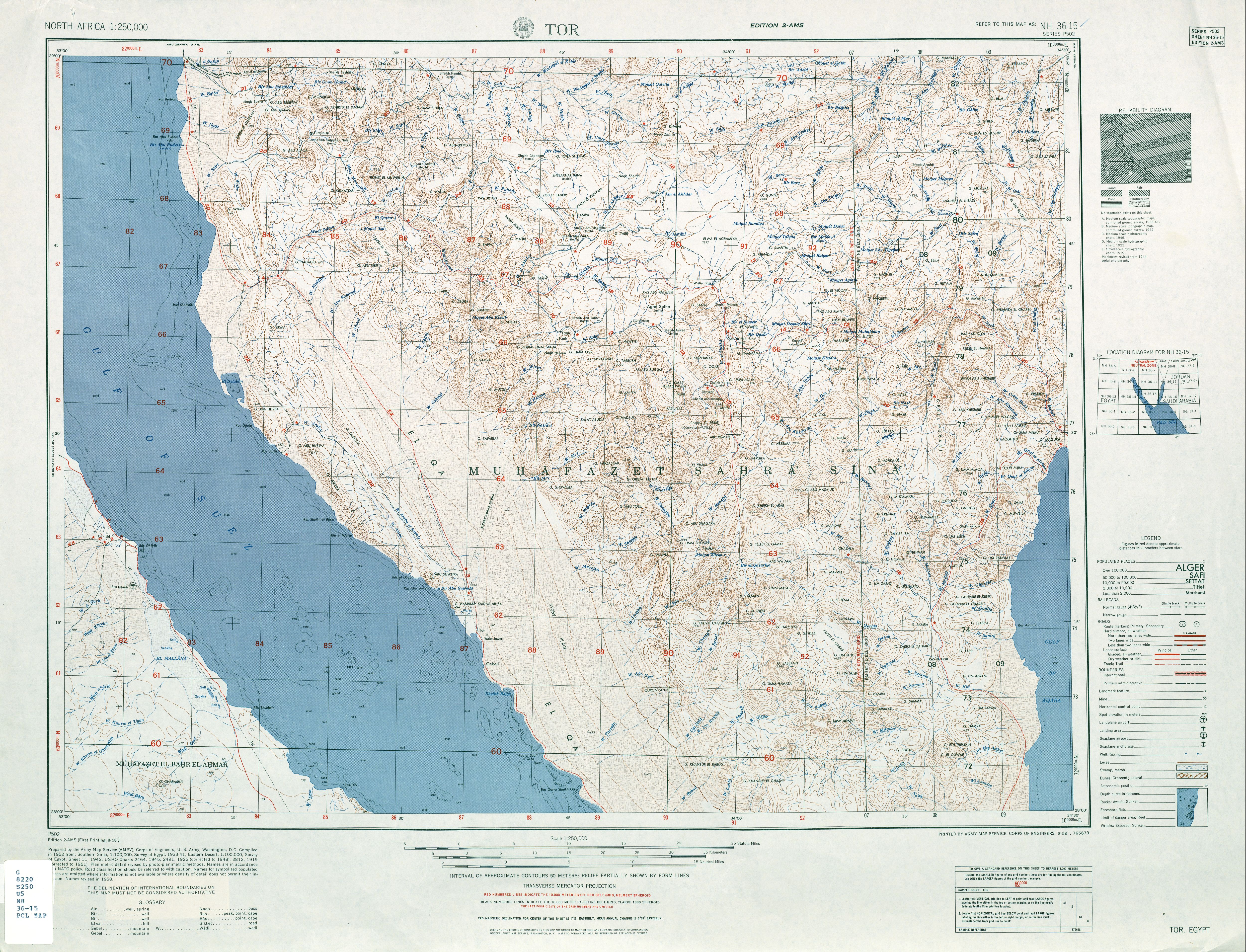
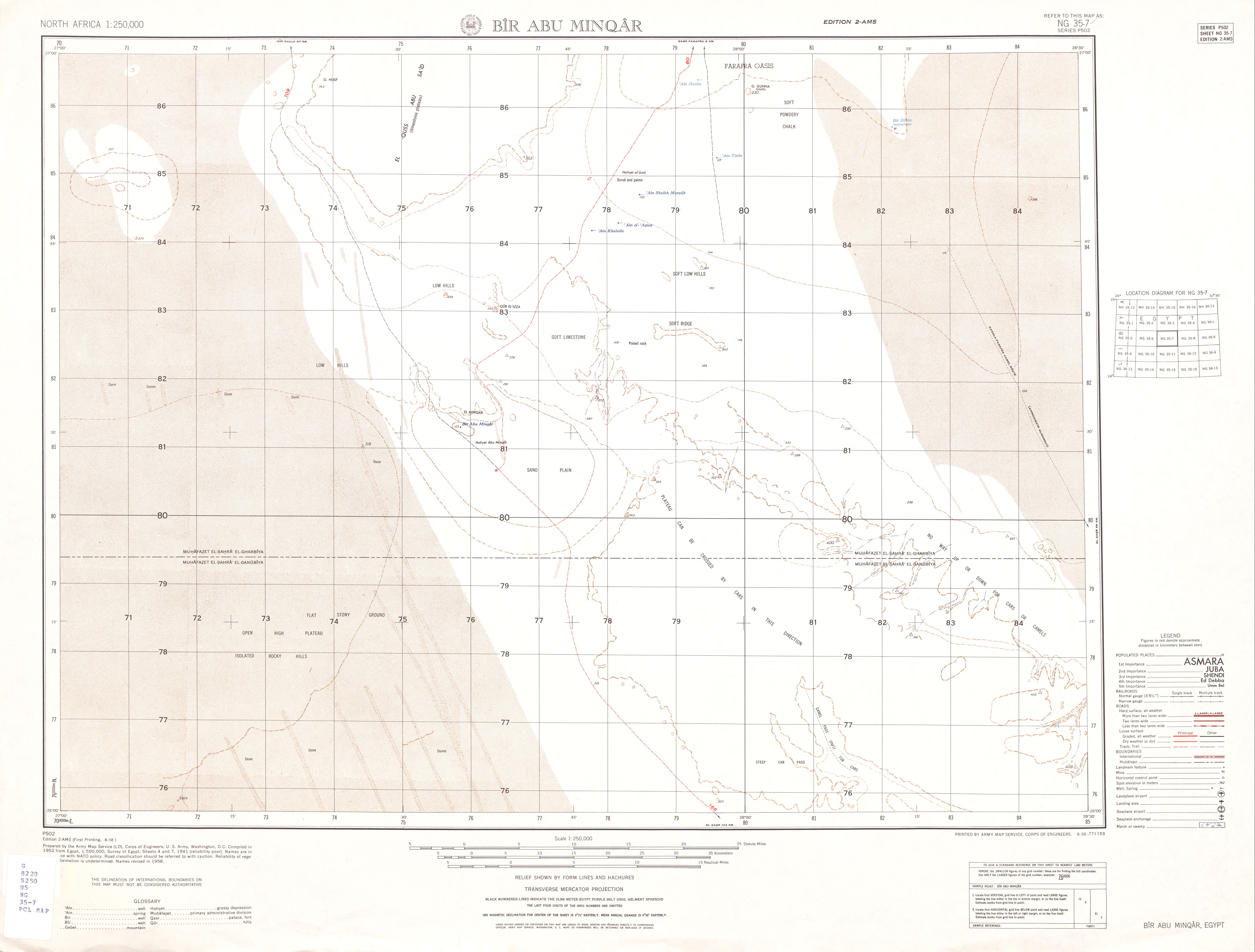
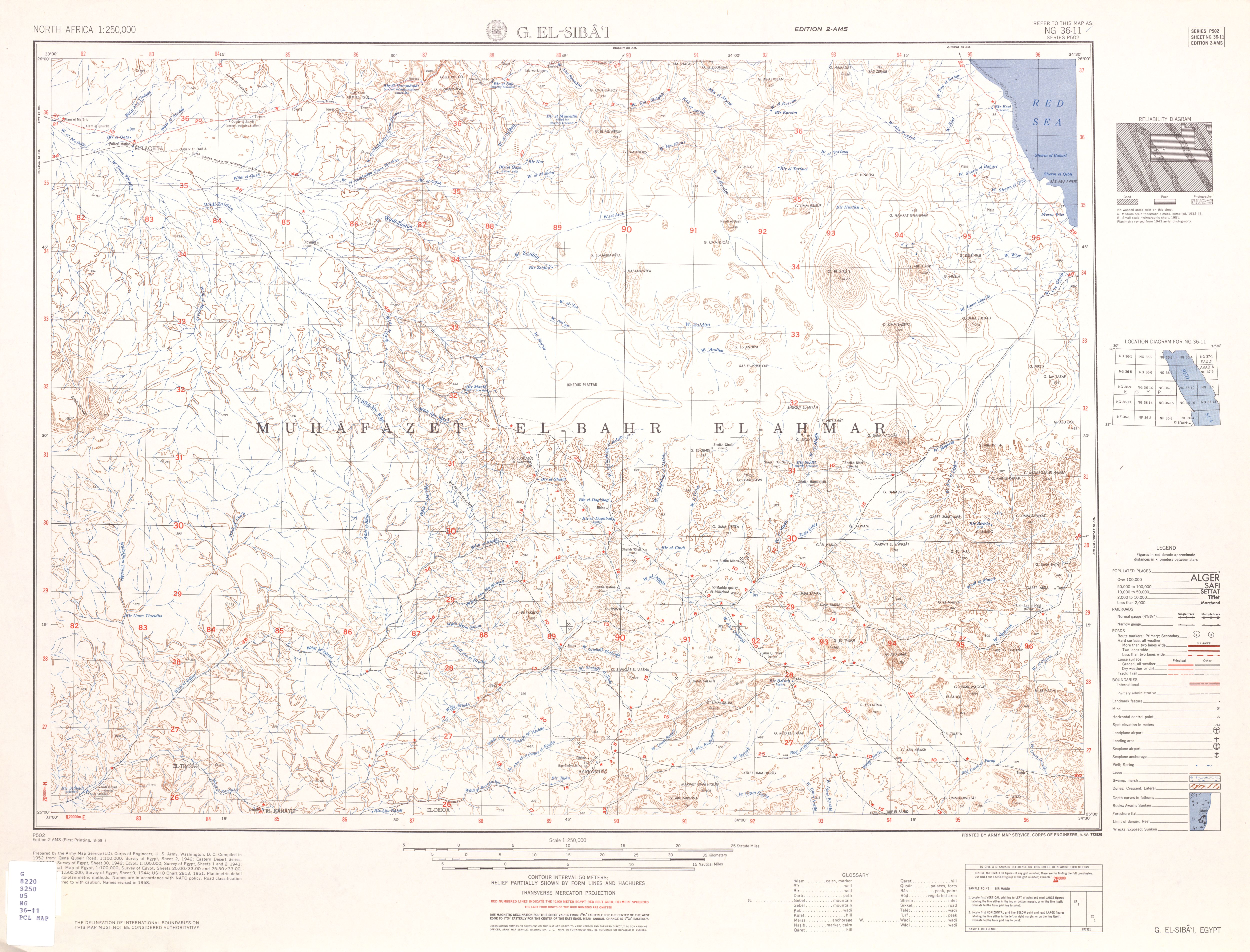
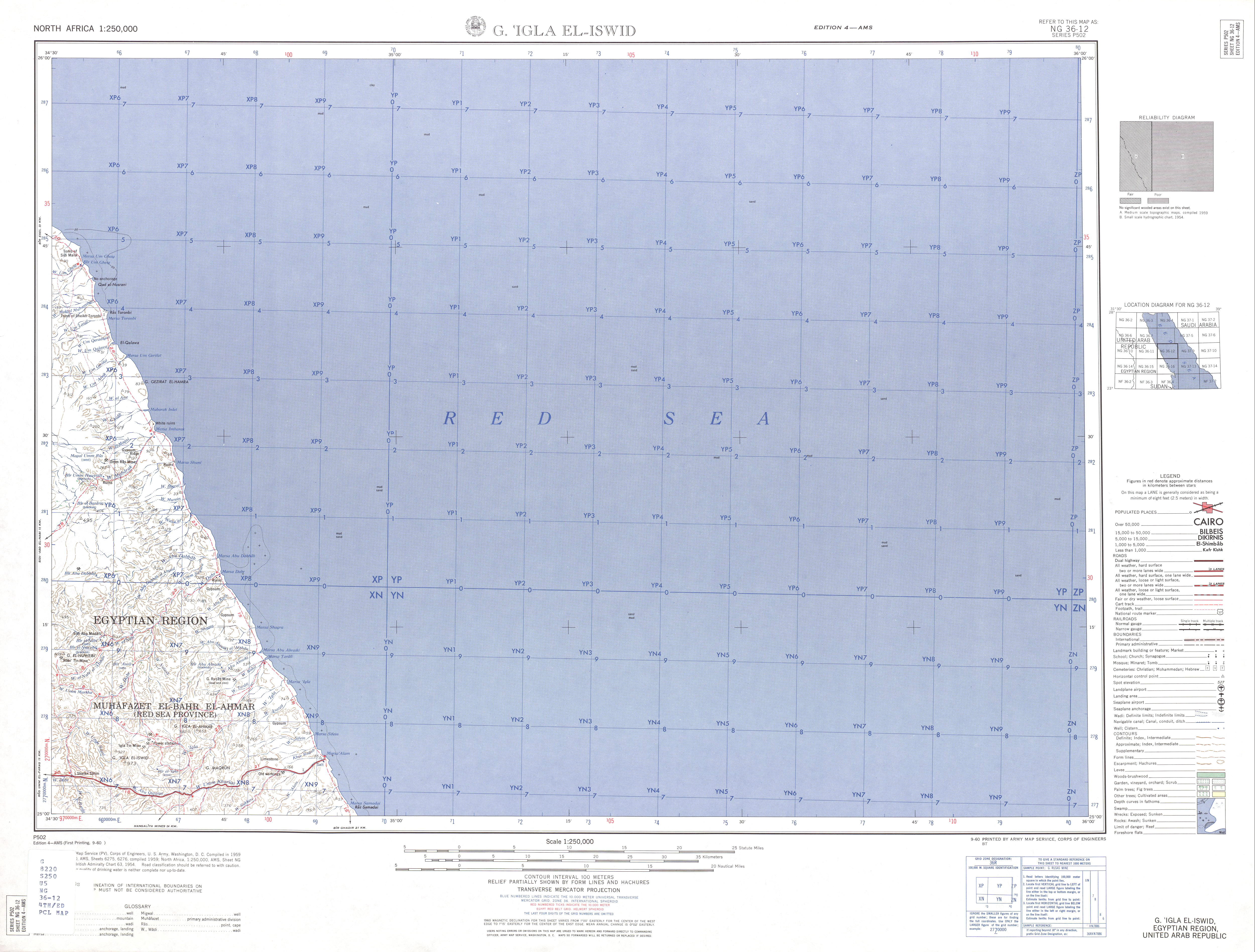
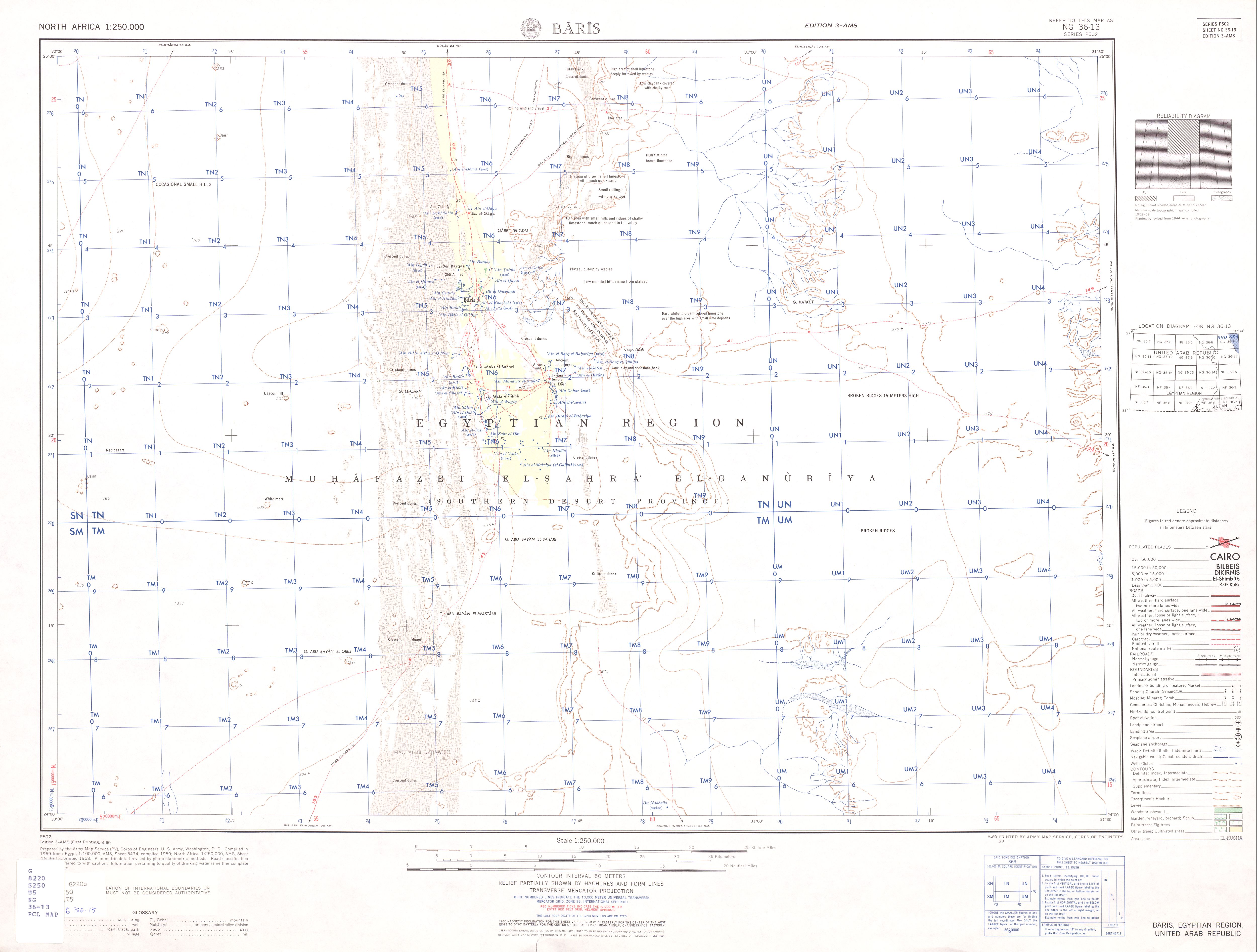
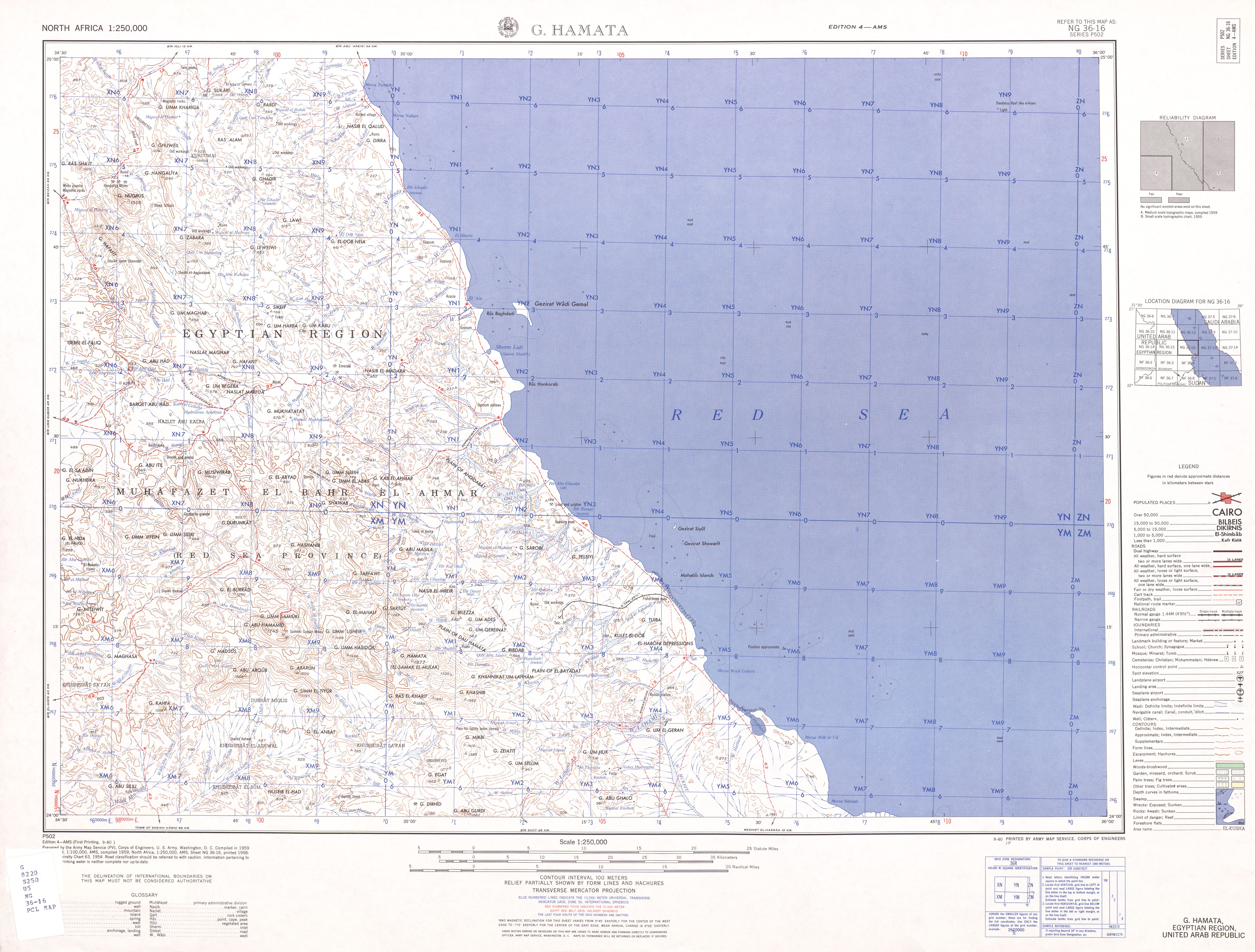
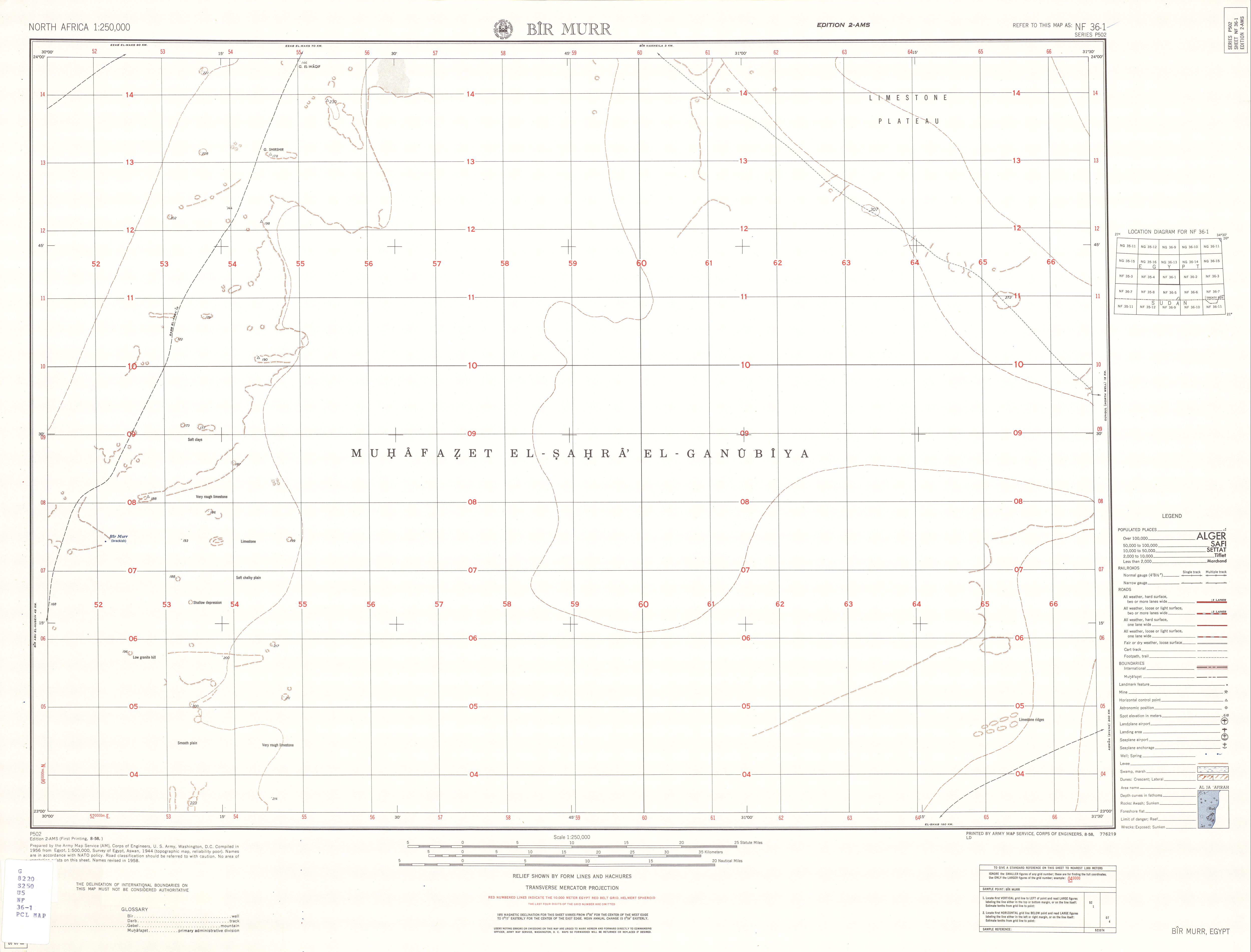
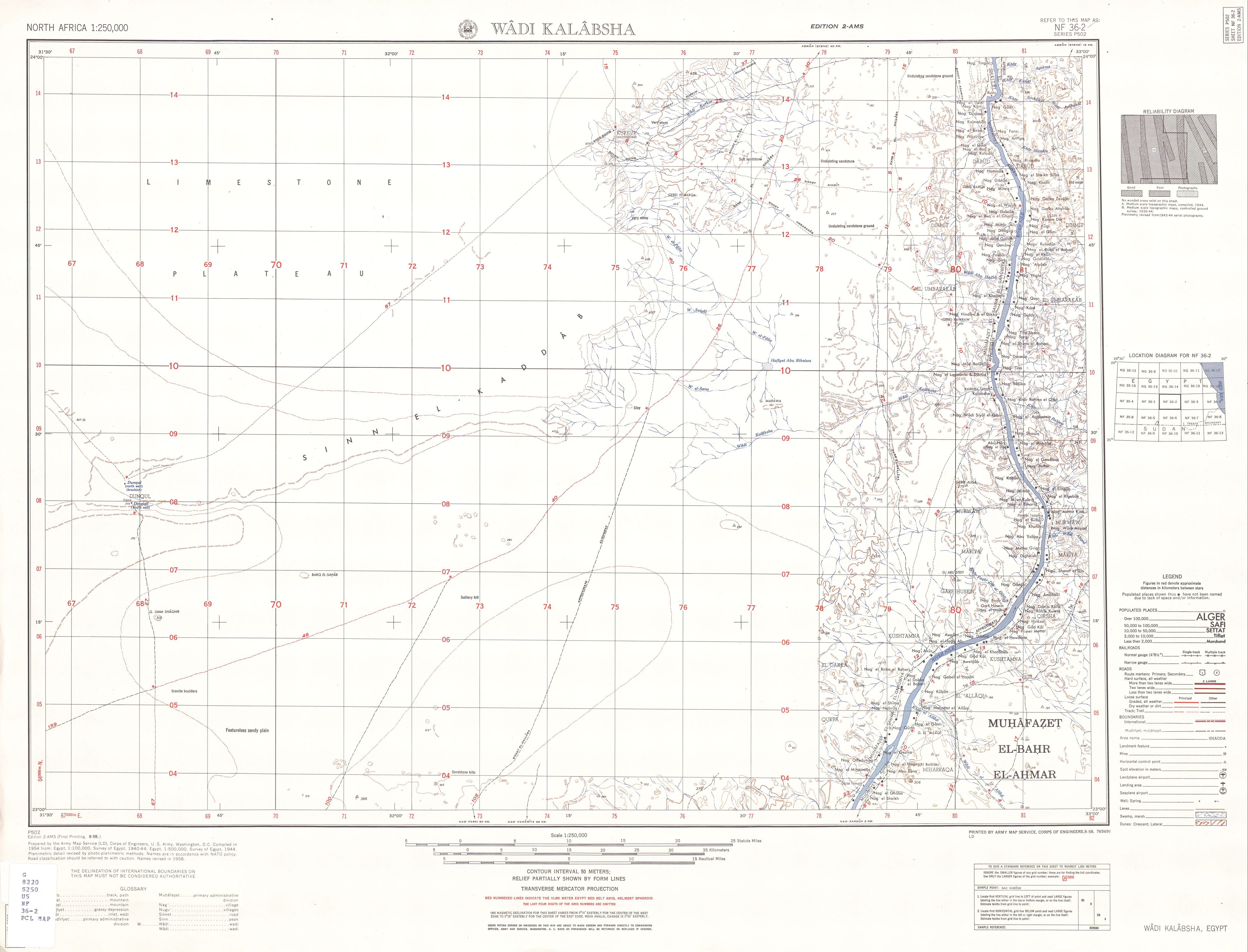
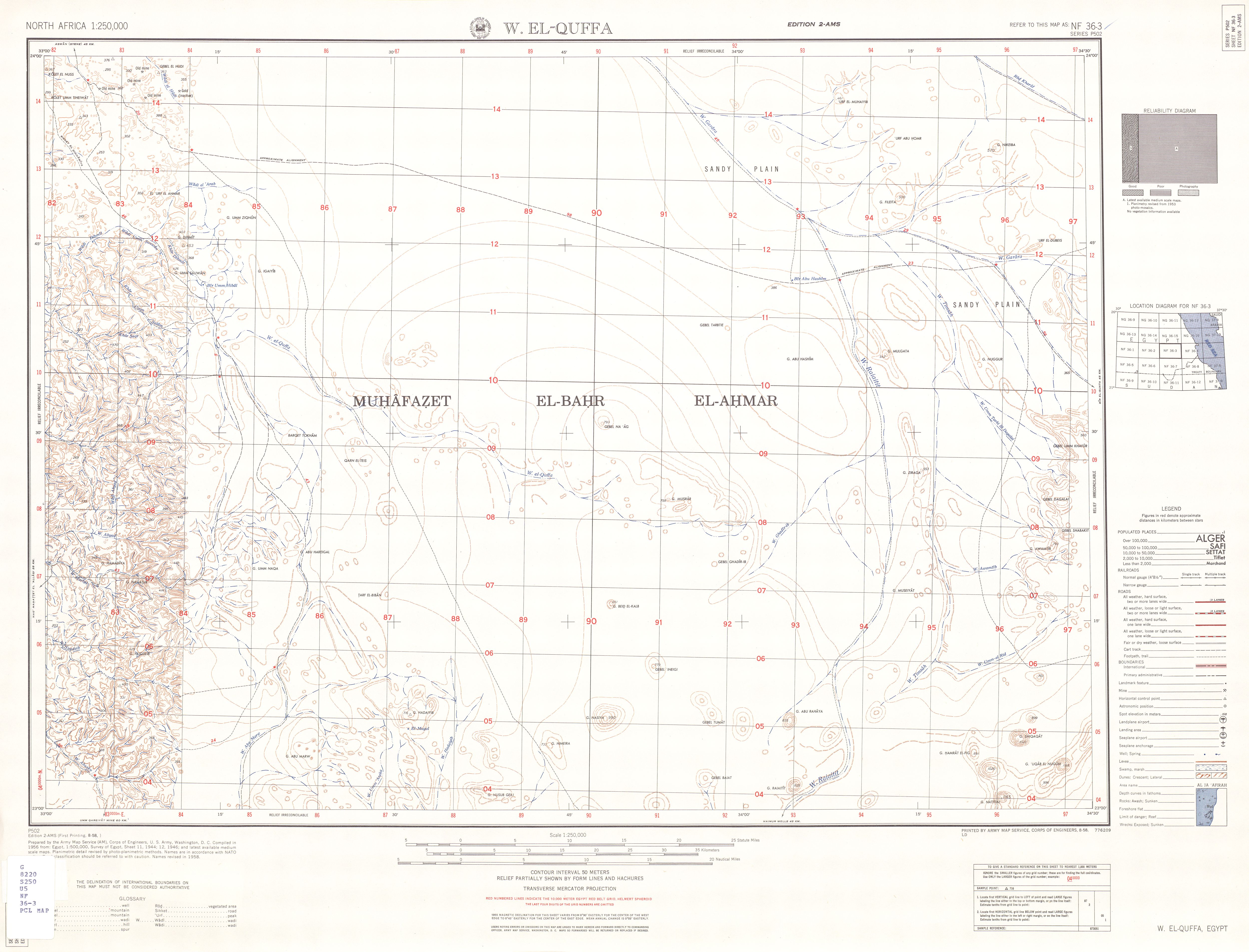
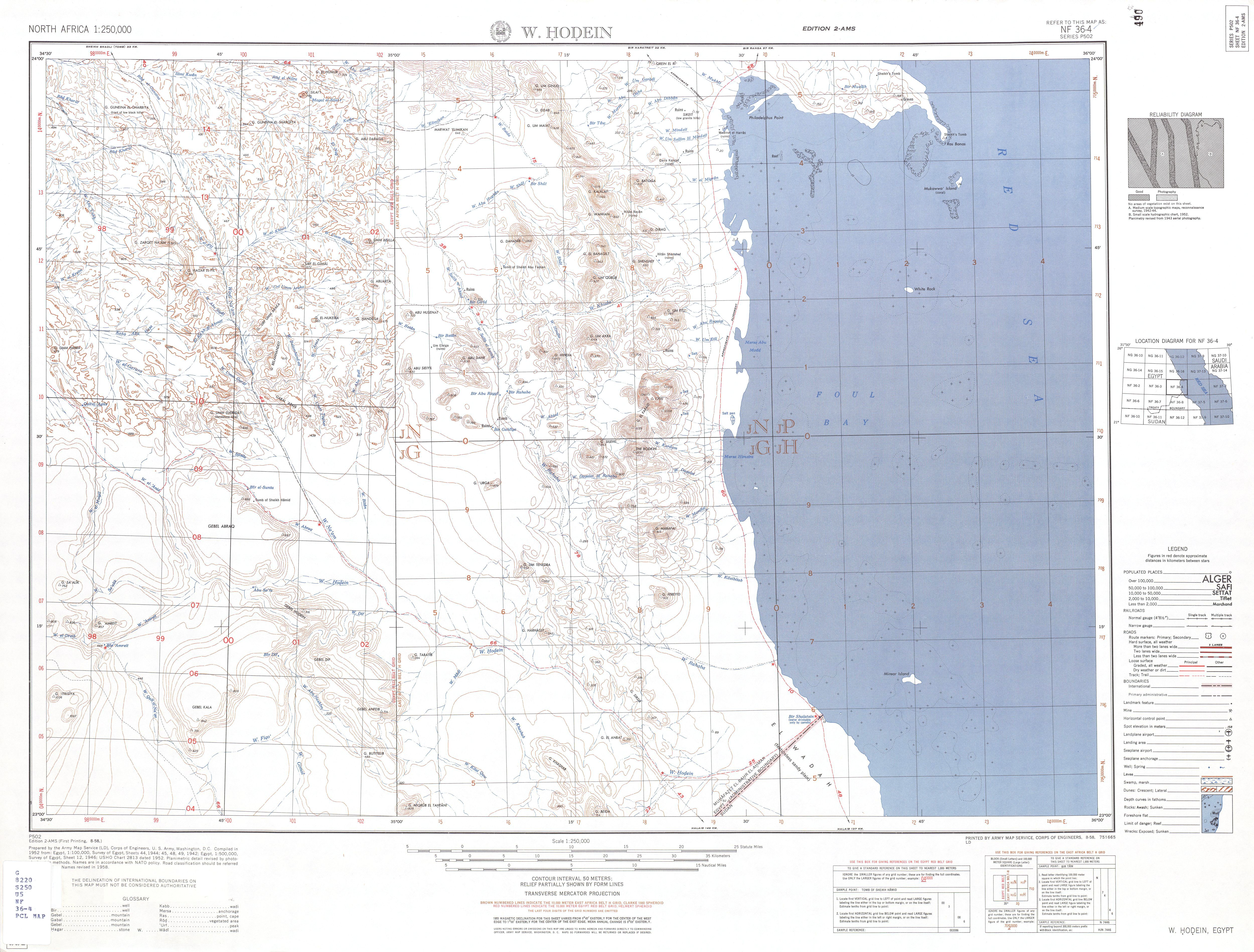
Topographic map of Egypt
Following is the Shortcuts of the topographic Map of Egypt, Scale 1: 250,000 in JPG format, from North west to South East
NH-35
NH 35-1 Bardia (31° 00'N, 24° 00'E - 32° 04'N, 25° 30'E)
NH 35-2 Sidi Barani (31° 00'N, 25° 30'E - 32° 00'N, 27° 00'E)
NH 35-3 Matrouh (31° 00'N, 27° 00'E - 32° 00'N, 28° 30'E)
NH 35-4 Alexandriah (31° 00'N, 28° 30'E - 32° 00'N, 30° 00'E)
NH 35-5 Qasr Ash Shaqitah (30° 00'N, 24° 00'E - 31° 00'N, 25° 30'E)
NH 35-6 Bir El Khamsa (30° 00'N, 25° 30'E - 31° 00'N, 27° 00'E)
NH 35-7 Bir Khalda (30° 00'N, 27° 00'E - 31° 00'N, 28° 30'E)
NH 35-8 Burg El 'Arab (30° 00'N, 28° 30'E - 31° 00'N, 30° 00'E)
NH 35-9 Giarabub (29° 00'N, 24° 00'E - 30° 00'N, 25° 30'E)
NH 35-10 Siwa Oasis (29° 00'N, 25° 30'E - 30° 00'N, 27° 00'E)
NH 35-11 Qaret Badr El-Din (29° 00'N, 27° 00'E - 30° 00'N, 28° 30'E)
NH 35-12 Ghard El Rammak (29° 00'N, 28° 30'E - 30° 00'N, 30° 00'E)
NH 35-13 Great Sand Sea (28° 00'N, 24° 00'E - 29° 00'N, 25° 30'E)
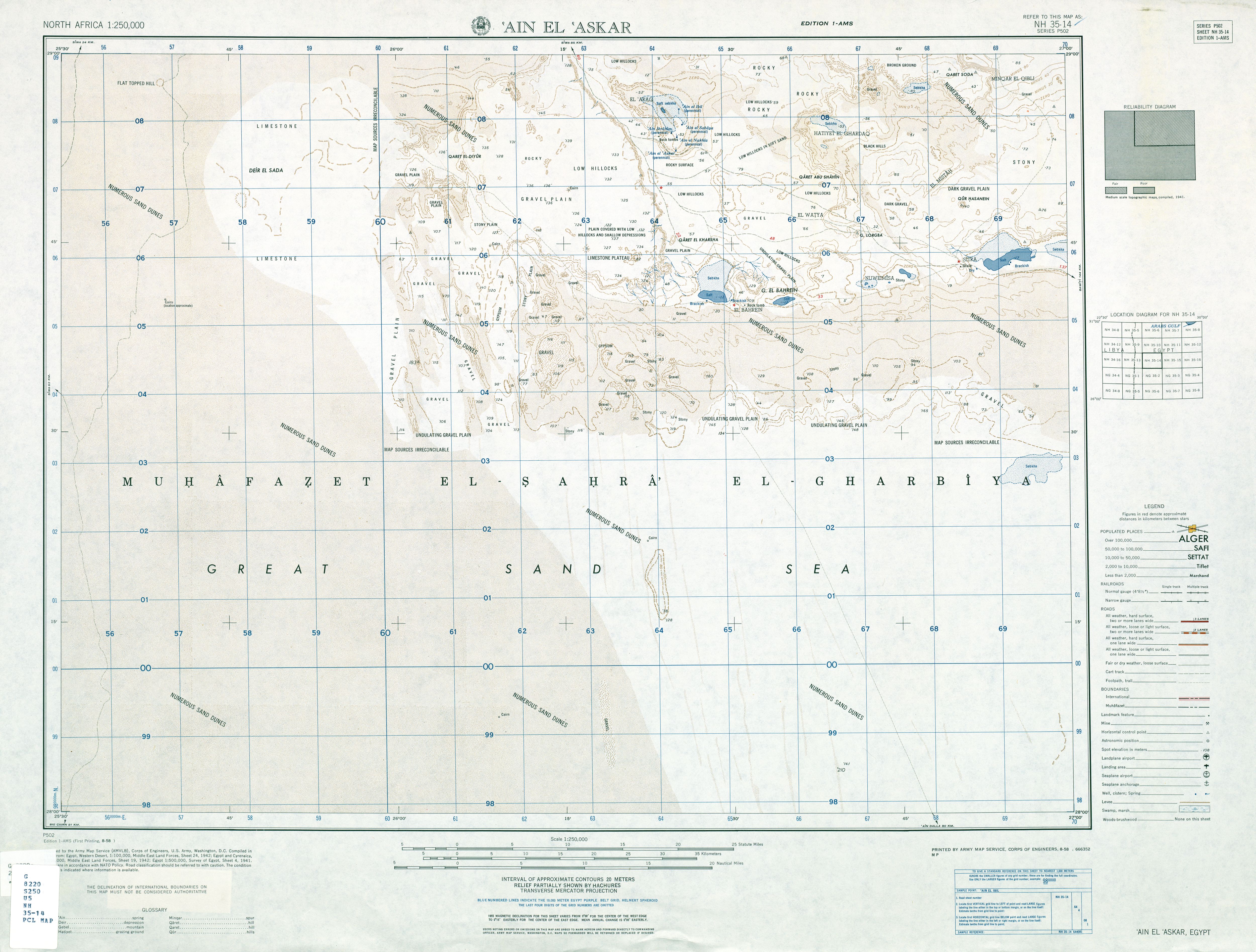
NH 35-14 'Ain El 'Askar (28° 00'N, 25° 30'E - 29° 00'N, 27° 00'E)
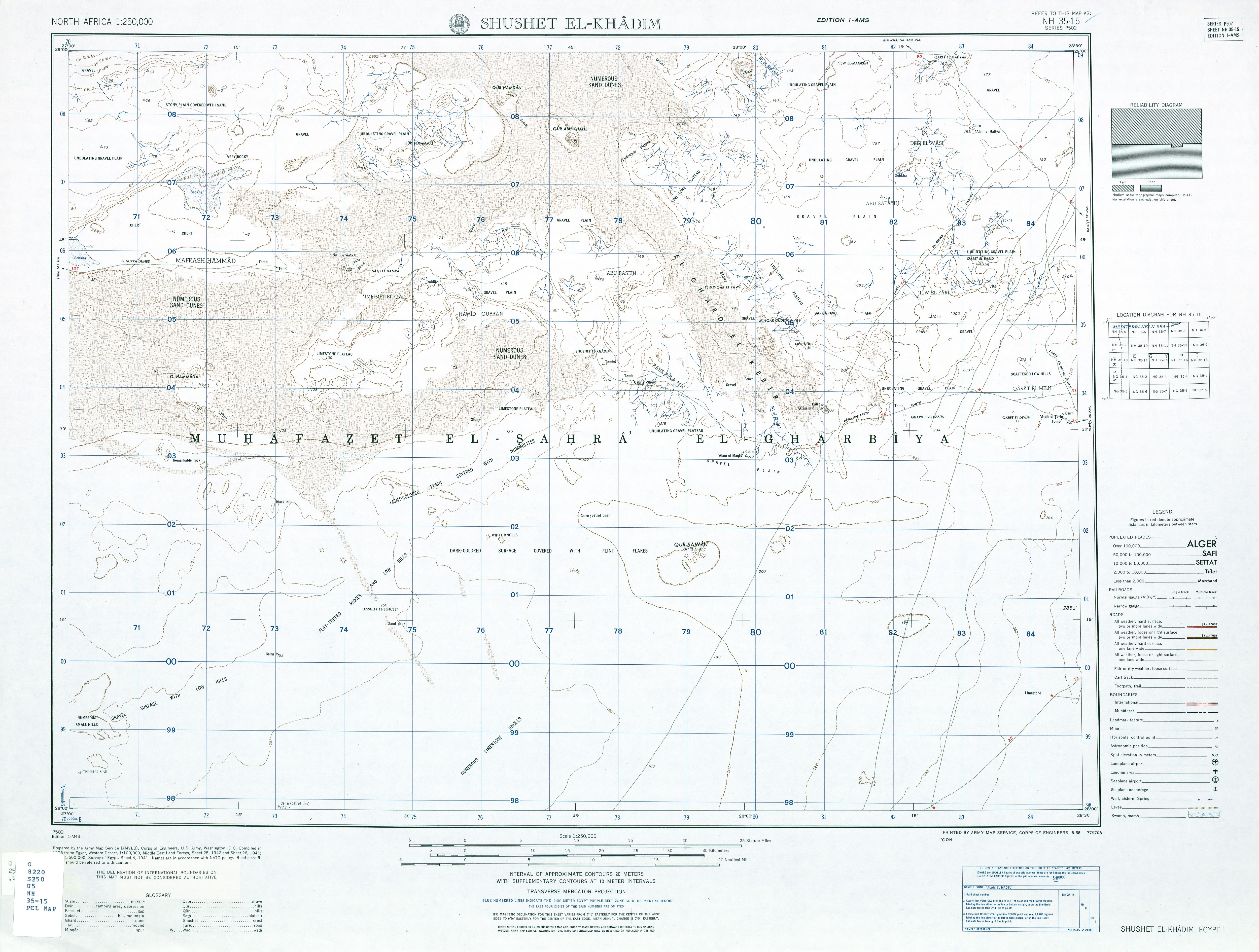
NH 35-15 Shushet El-Khadim (28° 00'N, 27° 00'E - 29° 00'N, 29° 30'E)
NH 35-16 Bahariya Oasis (28° 00'N, 29° 30'E - 29° 00'N, 31° 00'E)
==================================================================
NH-36
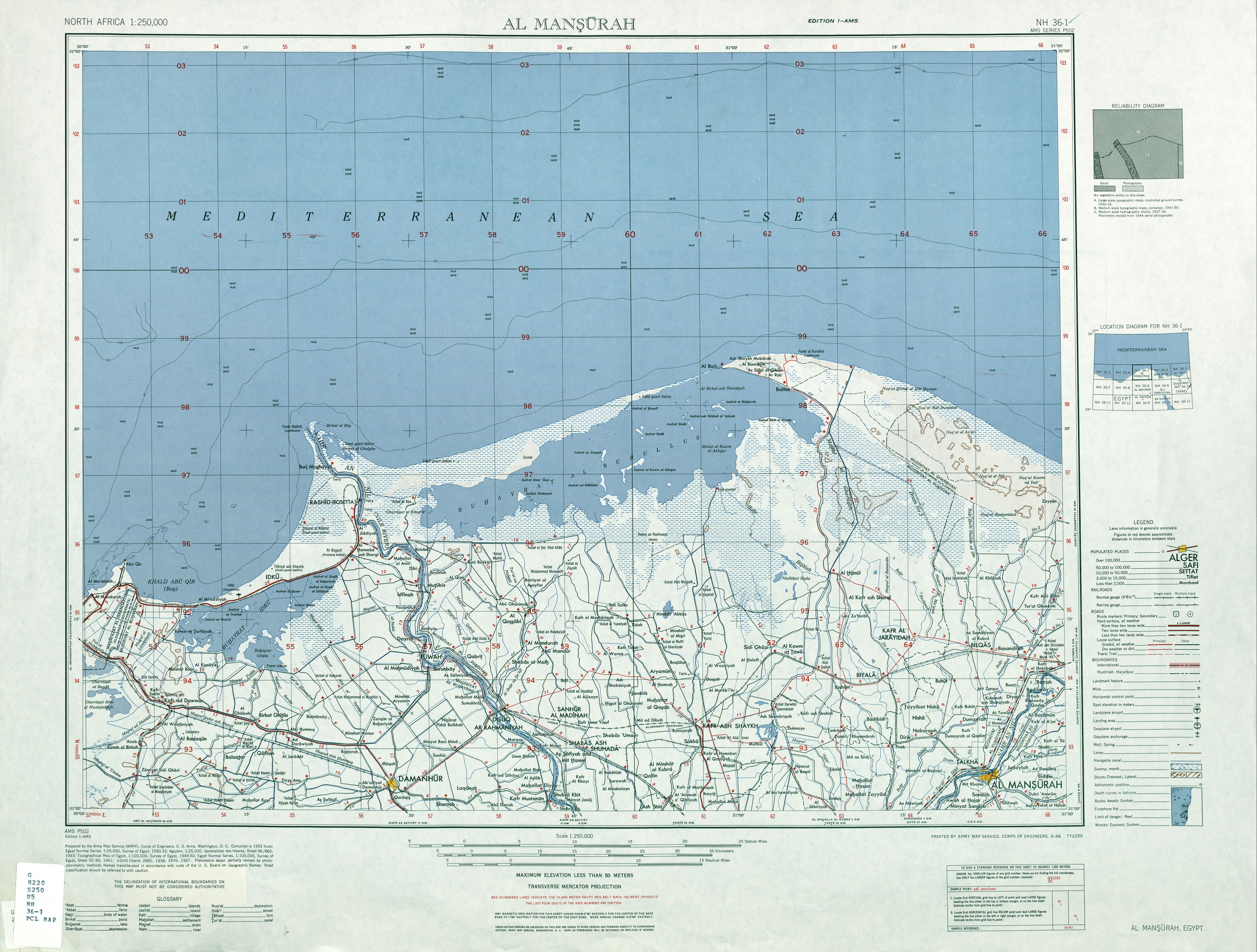
NH 36-1 Al Mansurah (31° 00'N, 30° 00'E - 32° 00'N, 31° 30'E)
NH 36-2 Port Said (31° 00'N, 31° 30'E - 32° 00'N, 33° 00'E)
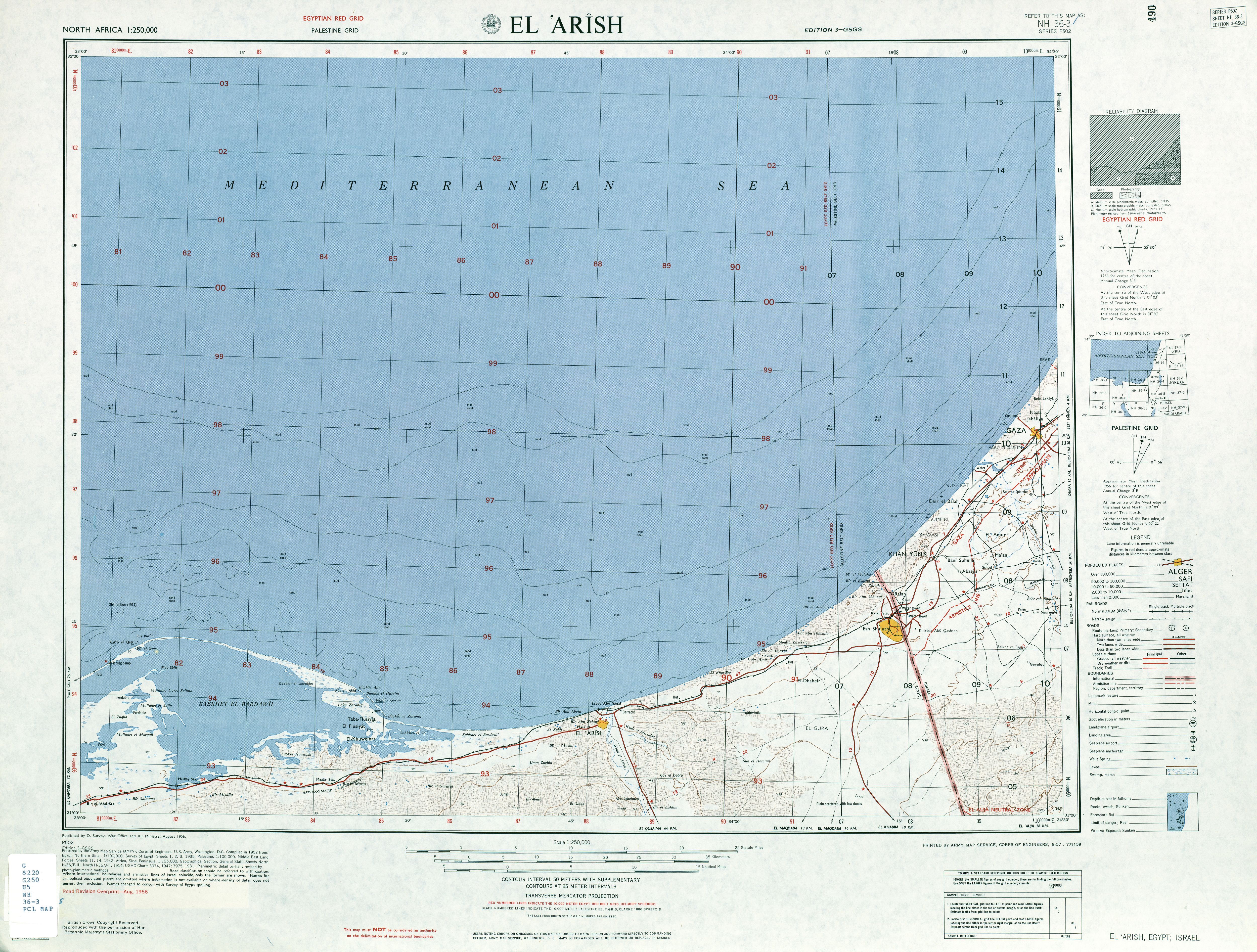
NH 36-3 El 'Arish (31° 00'N, 33° 00'E - 32° 00'N, 34° 30'E)
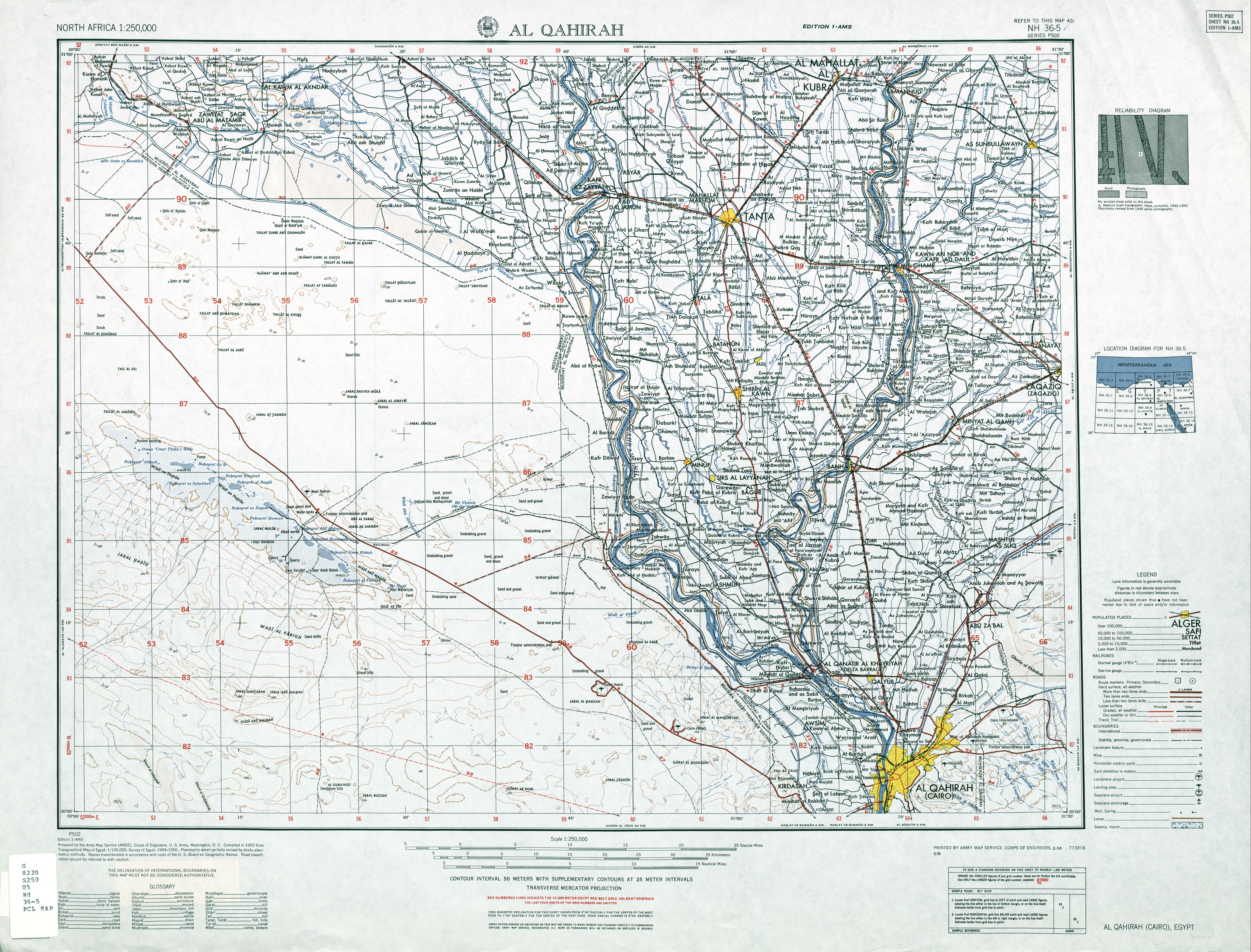
NH 36-5 Al Qahirah (30° 00'N, 30° 00'E - 31° 00'N, 31° 30'E)
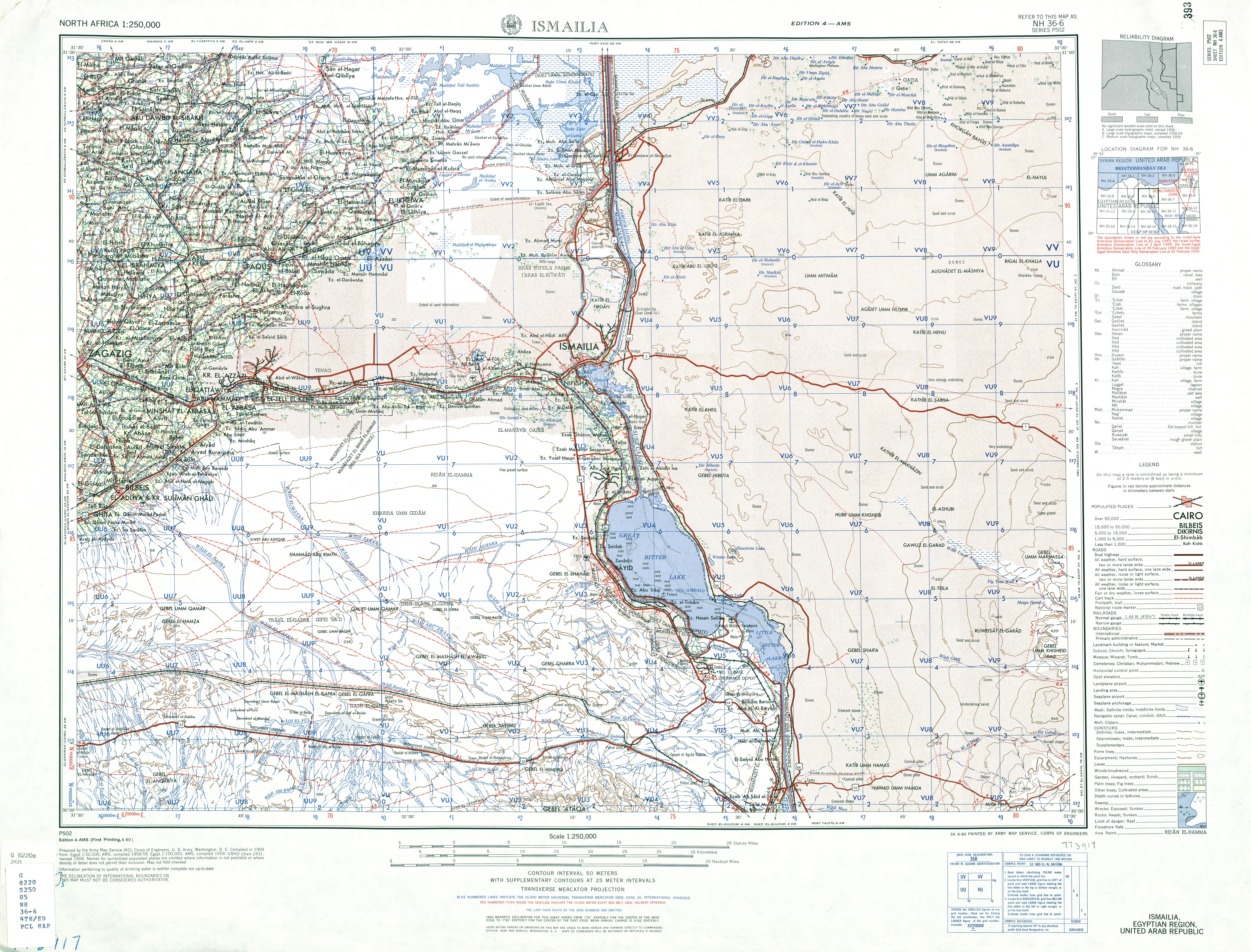
NH 36-6 Ismailia (30° 00'N, 31° 30'E - 31° 00'N, 33° 00'E)
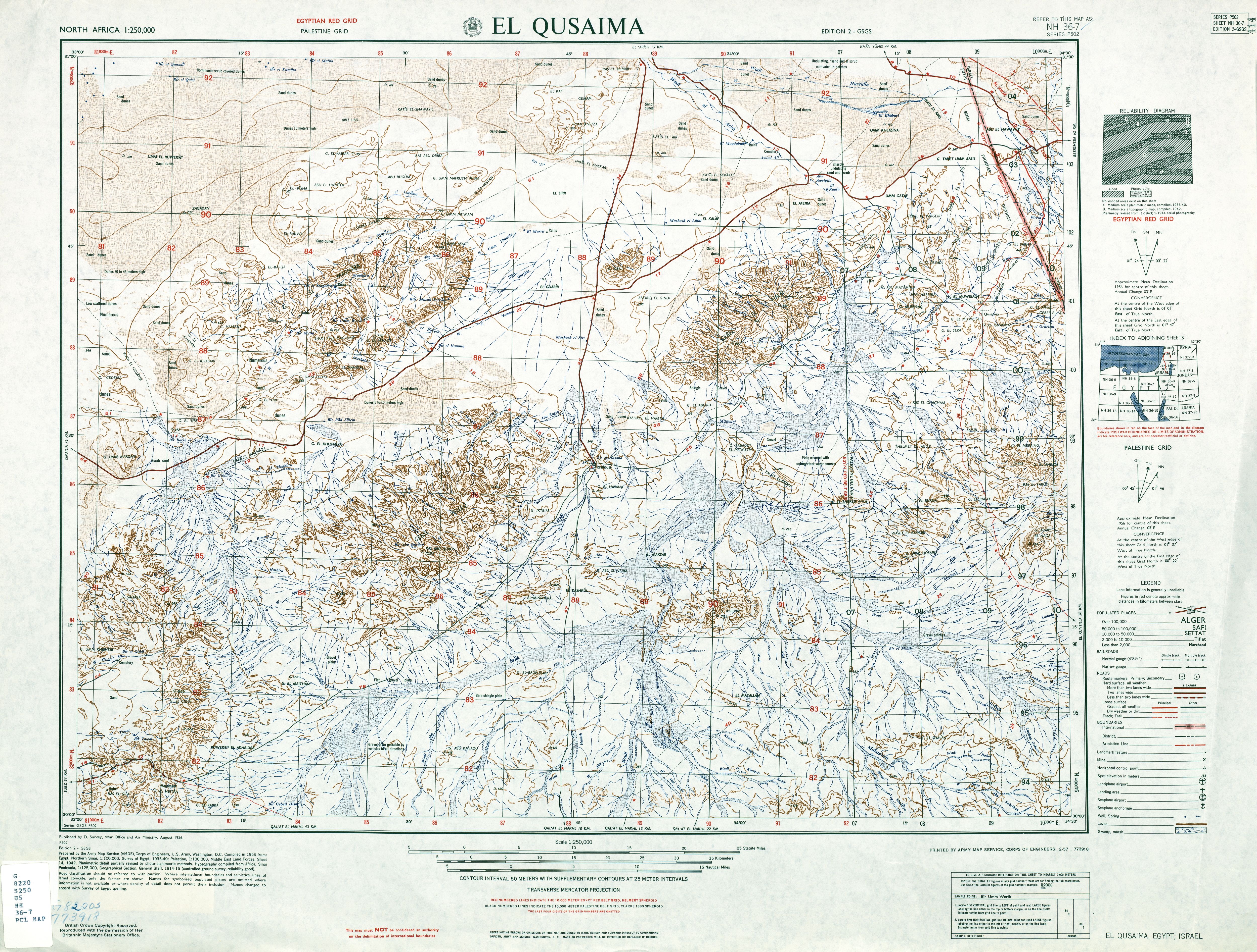
NH 36-7 El Qusaima (30° 00'N, 33° 30'E - 31° 00'N, 34° 30'E)
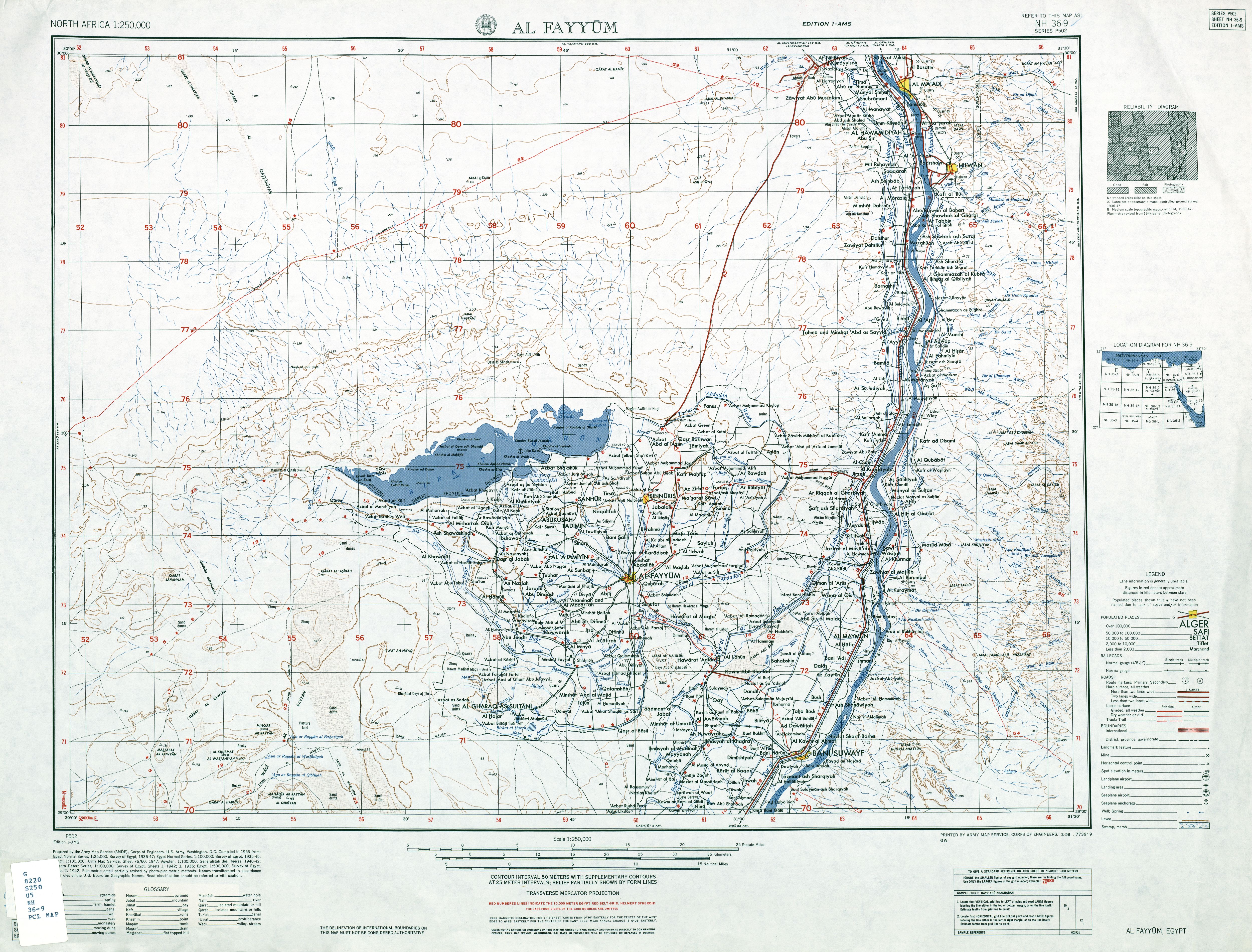
NH 36-9 Al Fayyum (29° 00'N, 30° 00'E - 30° 00'N, 31° 30'E)
NH 36-10 Suez (29° 00'N, 31° 30'E - 30° 00'N, 33° 00'E)
NH 36-11 Qal'at El Nakhl (29° 00'N, 33° 00'E - 30° 00'N, 34° 30'E)
NH 36-13 El-Minya (28° 00'N, 30° 00'E - 29° 00'N, 31° 30'E)
NH 36-14 G. Gharib (28° 00'N, 31° 30'E - 29° 00'N, 33° 00'E)
NH 36-15 Tor (28° 00'N, 33° 00'E - 29° 00'N, 34° 30'E)
==================================================================
NG-35
NG 35-4 'Ain Khoman (27° 00'N, 28° 30'E - 28° 00'N, 30° 00'E)
NG 35-7 Bir Abu Minqar (26° 00'N, 27° 00'E - 27° 00'N, 28° 30'E)
==================================================================
NG-36
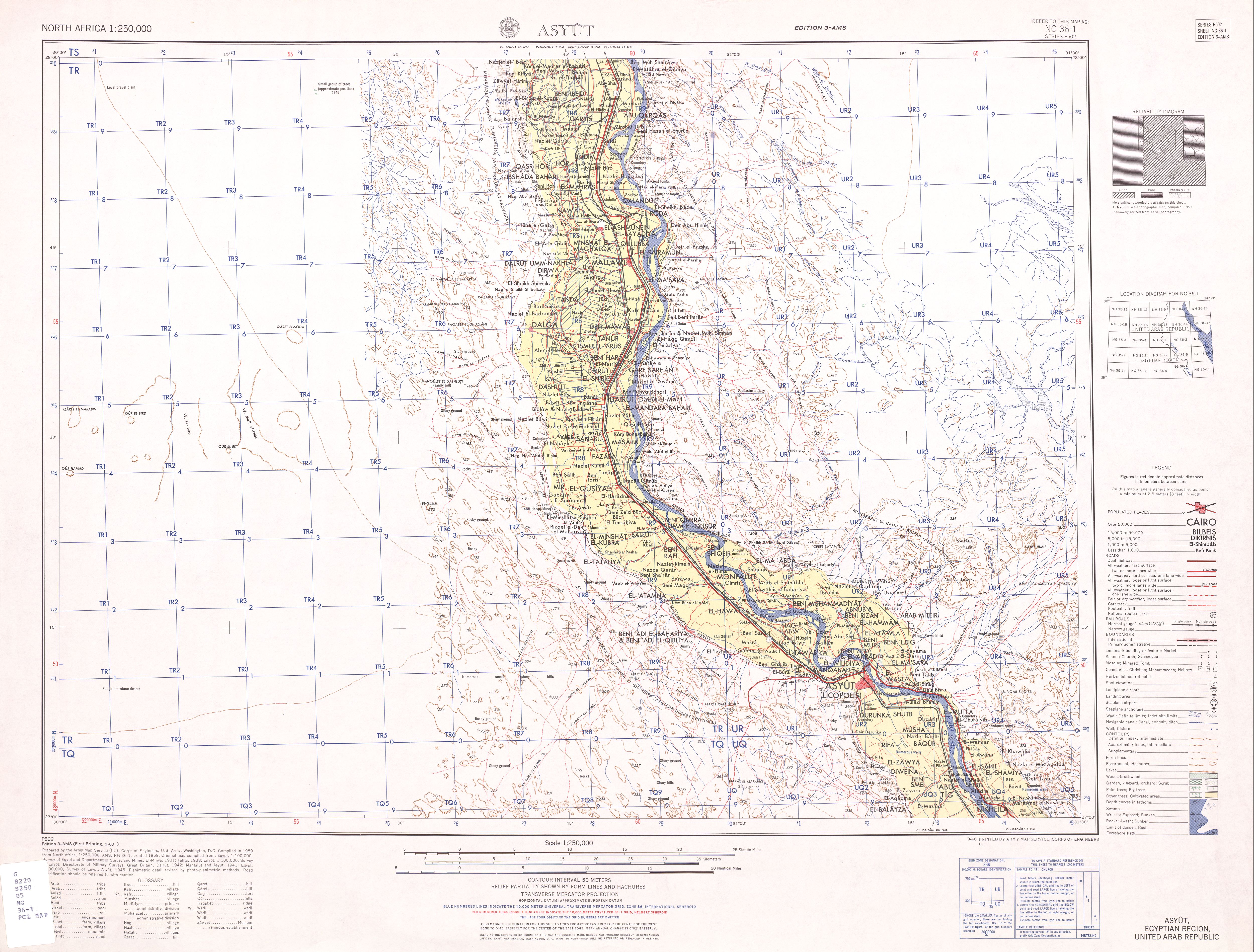
NG 36-1 Assyut (27° 00'N, 30° 00'E - 28° 00'N, 31° 30'E)
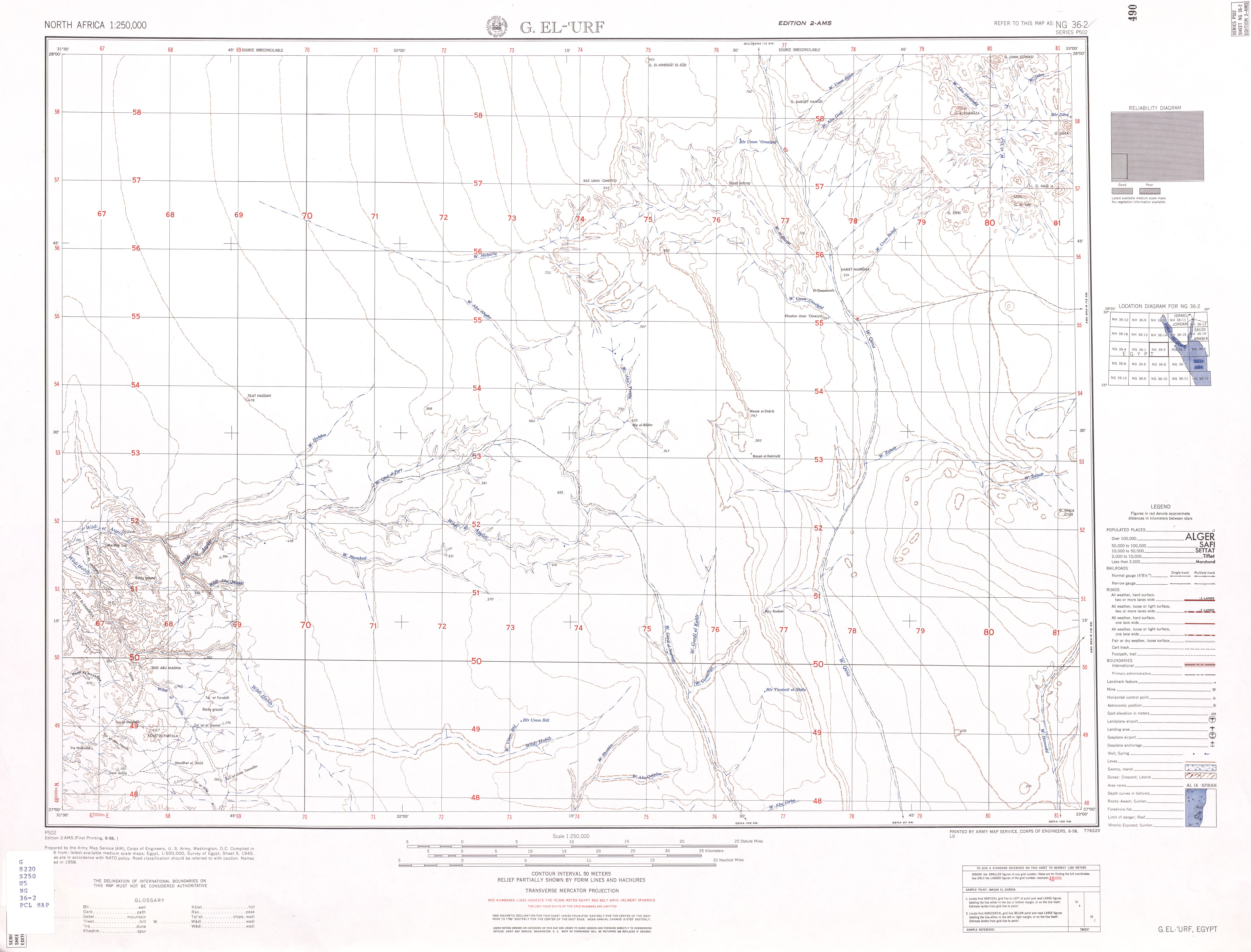
NG 36-2 G. El-'Urf (27° 00'N, 31° 30'E - 28° 00'N, 33° 00'E)
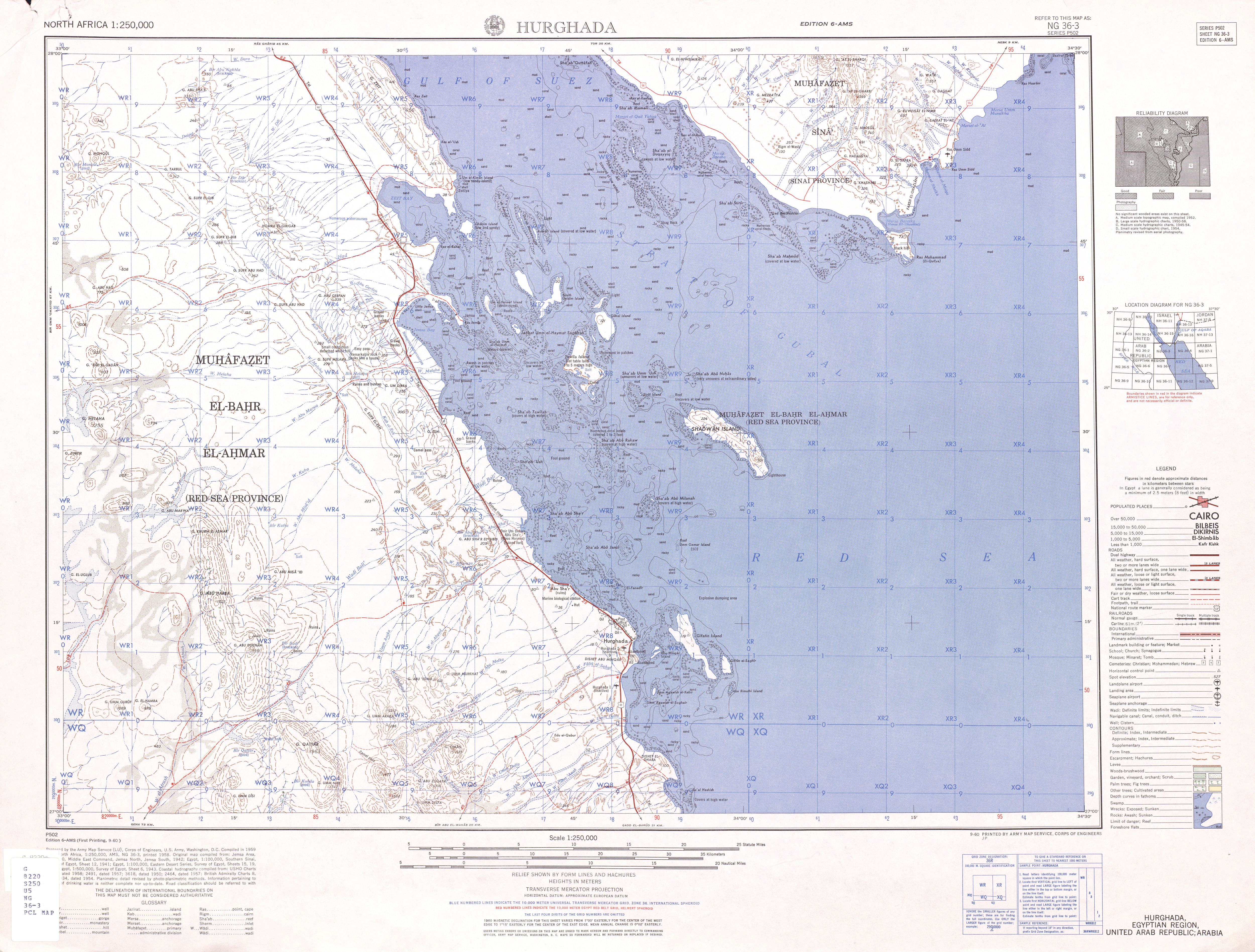
NG 36-3 Hurghada (27° 00'N, 33° 00'E - 28° 00'N, 34° 30'E)
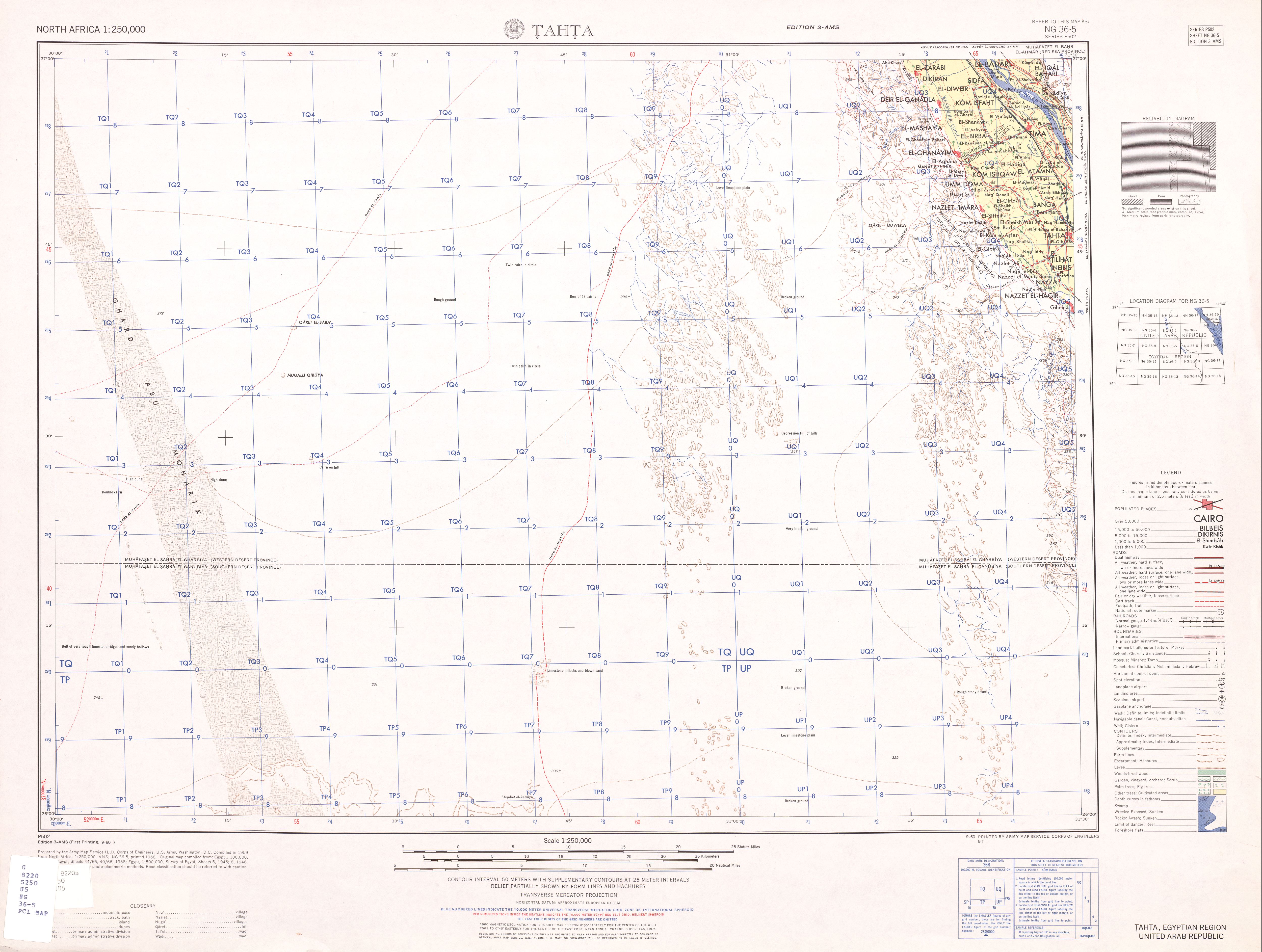
NG 36-5 Tahta (26° 00'N, 30° 00'E - 27° 00'N, 31° 30'E)
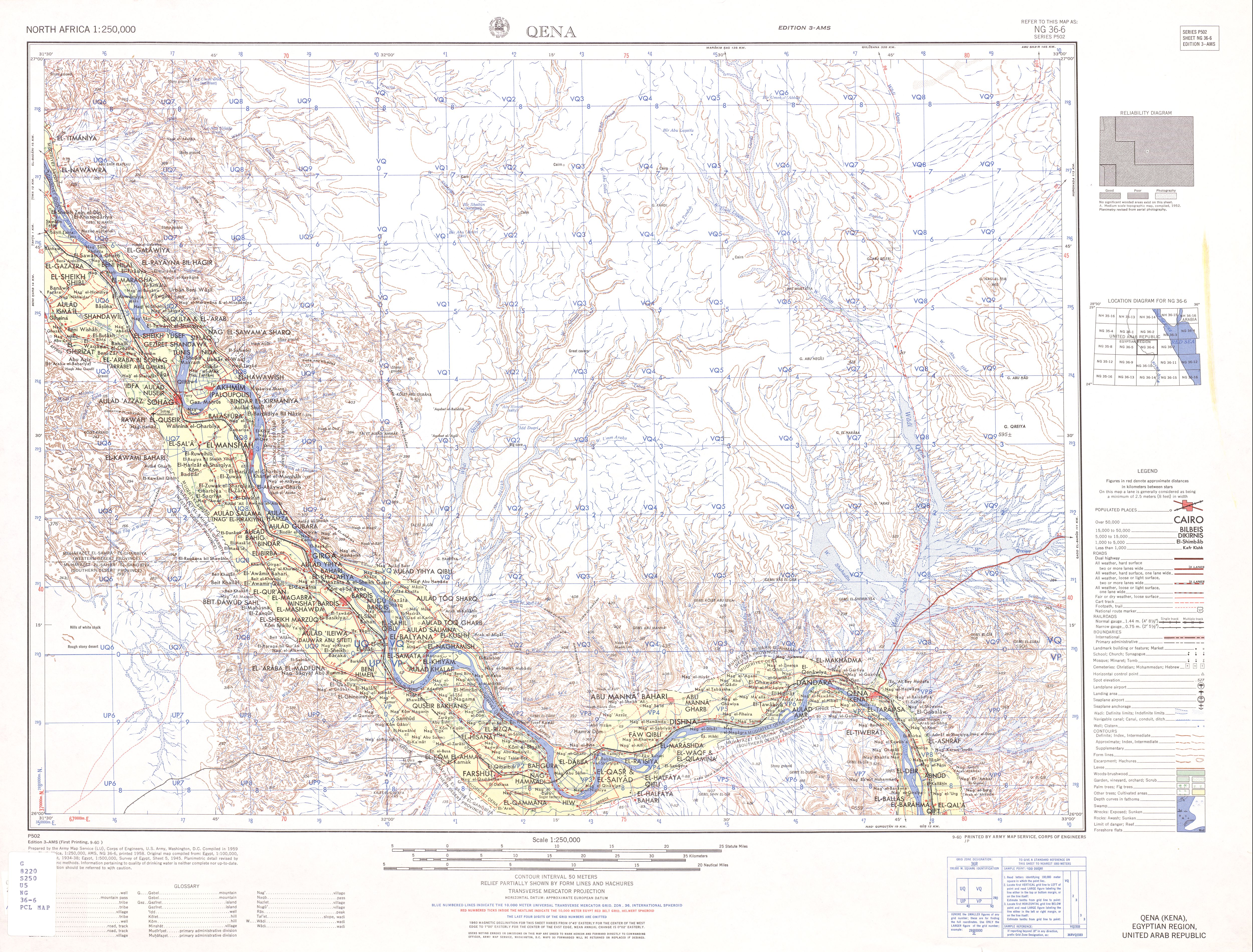
NG 36-6 Qena (26° 00'N, 31° 30'E - 27° 00'N, 33° 00'E)
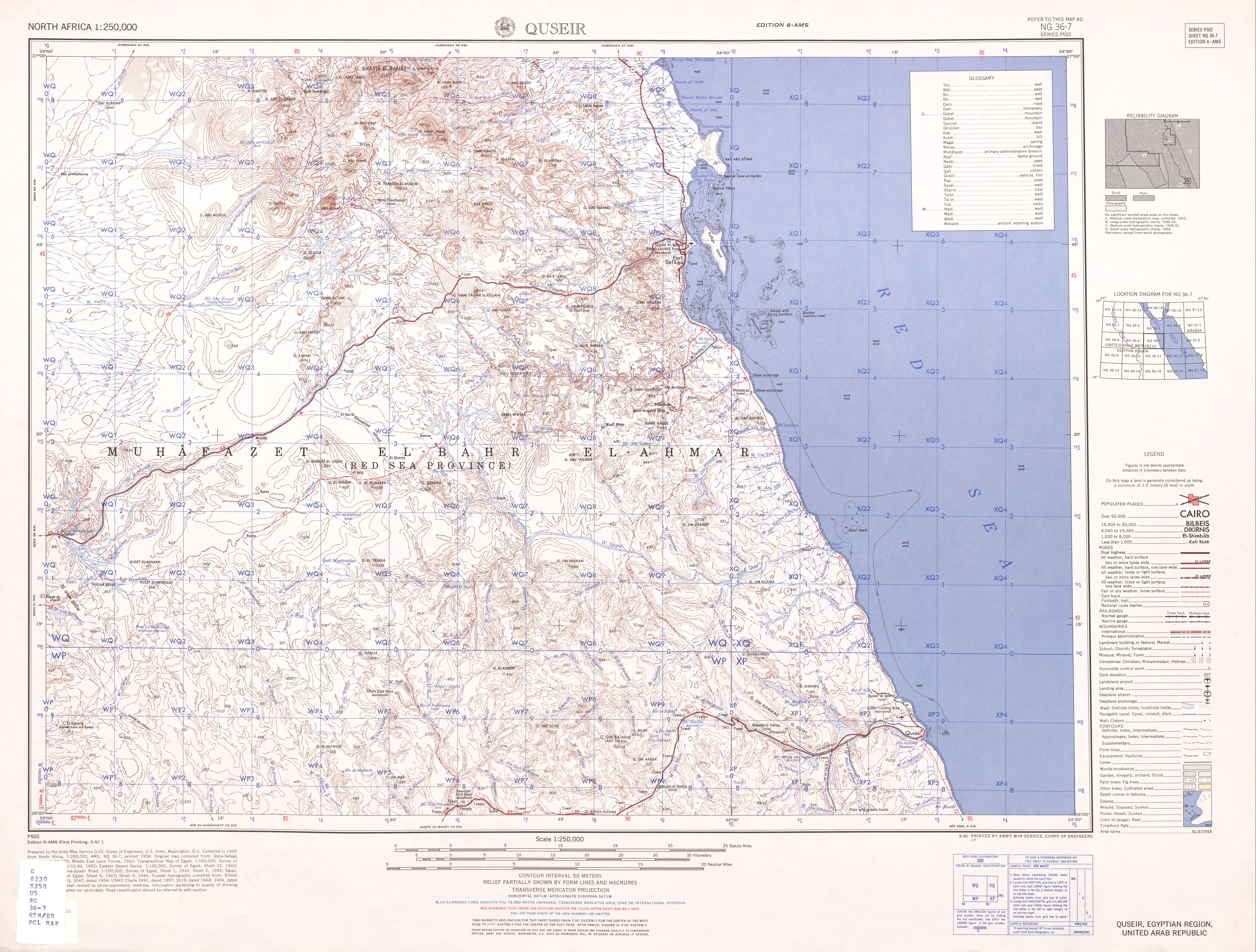
NG 36-7 Quseir (26° 00'N, 33° 00'E - 27° 00'N, 34° 30'E)
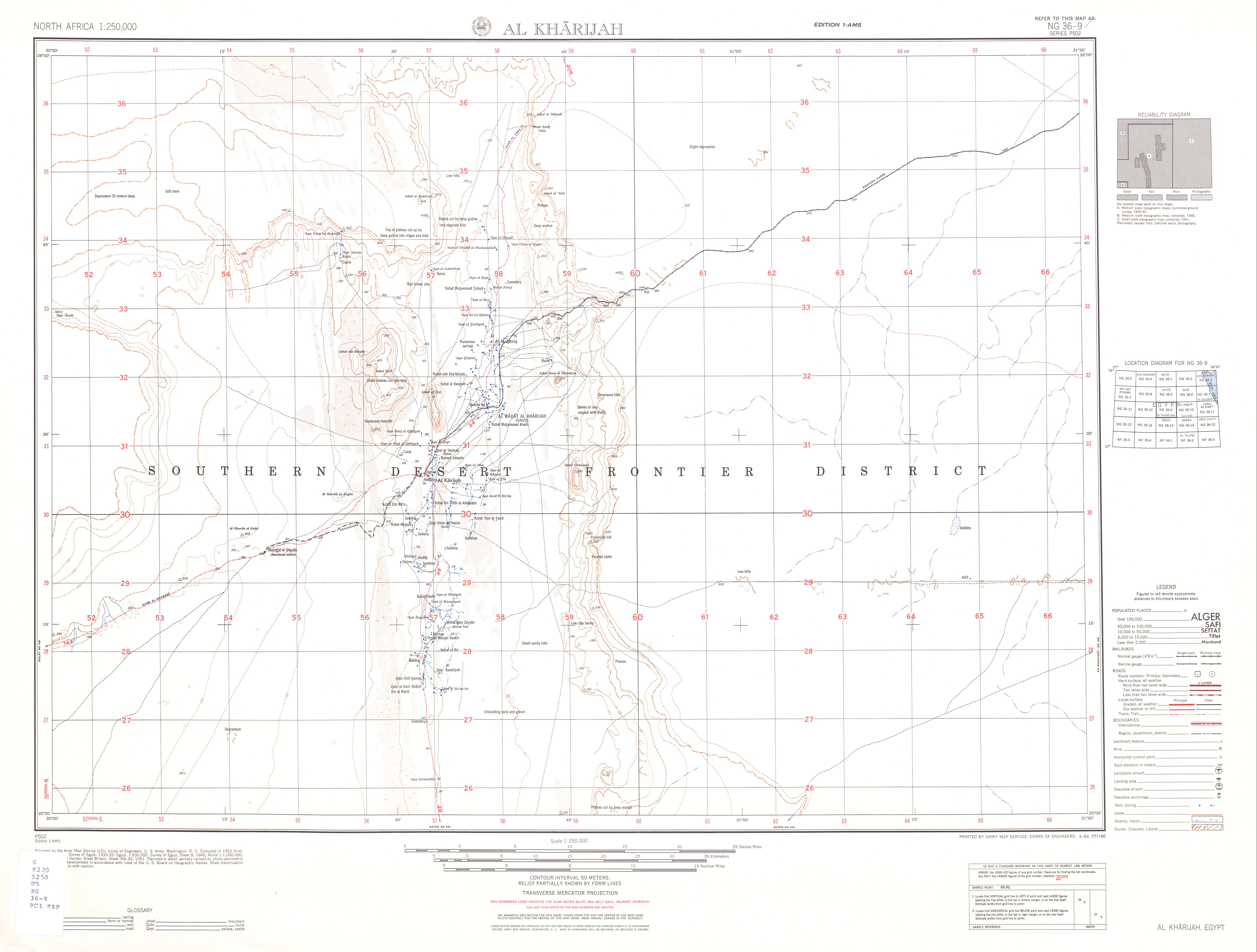
NG 36-9 Al Kharijah (25° 00'N, 30° 00'E - 26° 00'N, 31° 30'E)
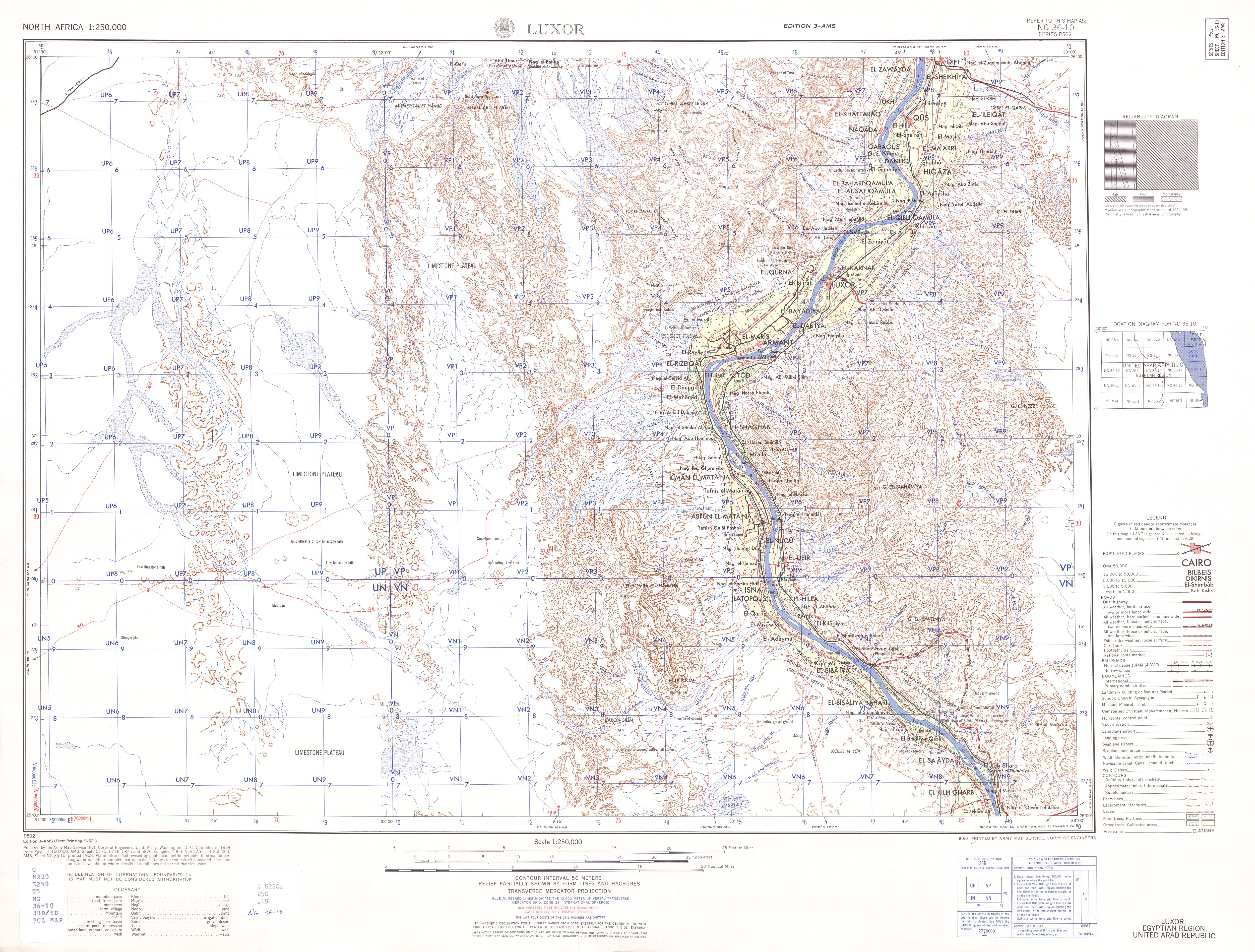
NG 36-10 Luxor (25° 00'N, 31° 30'E - 26° 00'N, 33° 00'E)
NG 36-11 G. El-Siba'i (25° 00'N, 33° 00'E - 26° 00'N, 34° 30'E)
NG 36-12 G. 'Igla El-Iswid (25° 00'N, 34° 30'E - 26° 00'N, 36° 00'E)
NG 36-13 Baris (24° 00'N, 30° 00'E - 25° 00'N, 31° 30'E)
NG 36-14 Aswan (24° 00'N, 31° 30'E - 25° 00'N, 33° 00'E)
NG 36-15 Wadi Sha'it (24° 00'N, 33° 00'E - 25° 00'N, 34° 30'E)
NG 36-16 G. Hamata (24° 00'N, 34° 30'E - 25° 00'N, 36° 00'E)
==================================================================
NF-36
NF 36-1 Bir Murr (23° 00'N, 30° 00'E - 24° 00'N, 31° 30'E)
NF 36-2 Wadi Kalabsha (23° 00'N, 31° 30'E - 24° 00'N, 33° 00'E)
NF 36-3 W. El-Quffa (23° 00'N, 33° 00'E - 24° 00'N, 34° 30'E)
NF 36-4 W. Hodein (23° 00'N, 34° 30'E - 24° 00'N, 36° 00'E)
NF 36-5 Dubayrah (22° 00'N, 30° 00'E - 23° 00'N, 31° 30'E)
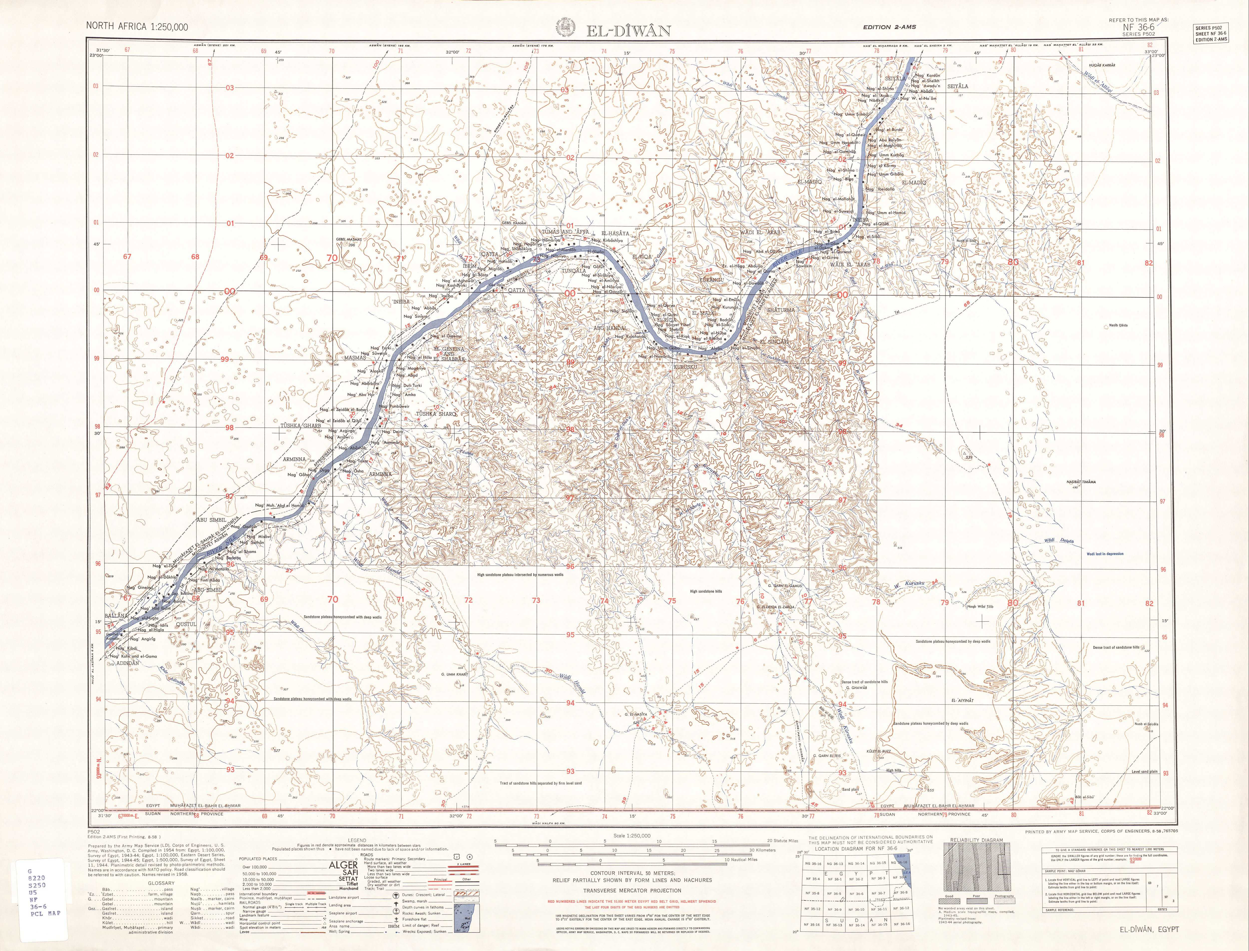
NF 36-6 El-Diwan (22° 00'N, 31° 30'E - 23° 00'N, 33° 00'E)
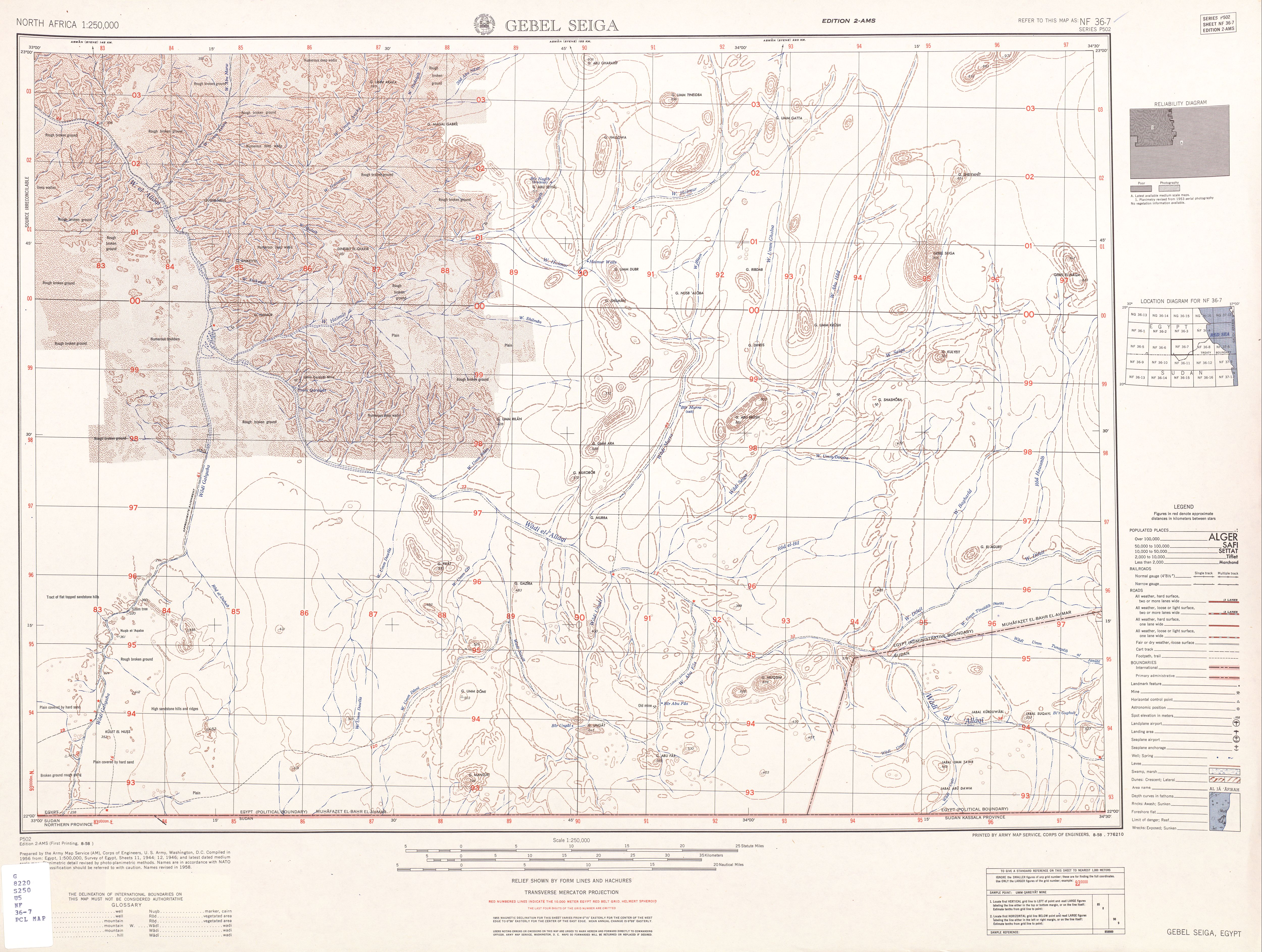
NF 36-7 Gebel Seiga (22° 00'N, 33° 00'E - 23° 00'N, 34° 30'E)
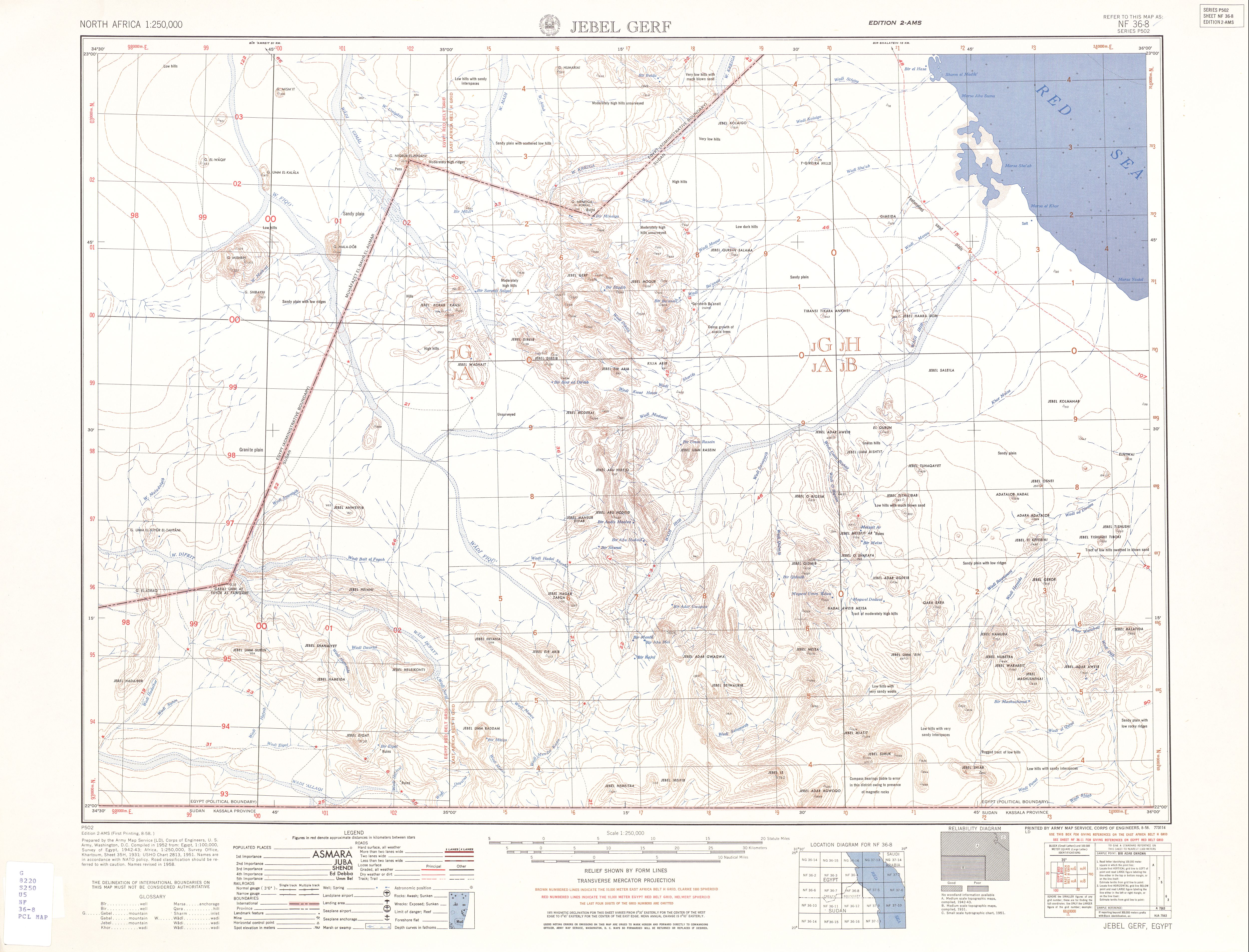
NF 36-8 Gebel Gerf (22° 00'N, 34° 30'E - 23° 00'N, 36° 00'E)
==================================================================
NF-37
NF 37-5 Halaib (22° 00'N, 36° 00'E - 23° 00'N, 37° 30'E)
Subscribe to:
Posts (Atom)